Tropical Storm Isaias has strengthened into a hurricane this evening as it starts to pull away from the Dominican Republic and head towards the Bahamas. Meanwhile, the threat to the East Coast is starting to increase.
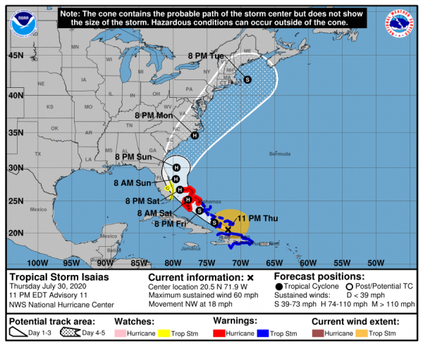
As of midnight Friday morning, Isaias was centered about 80 miles southeast of Great Inagua Island in the southeastern Bahamas, and was moving toward the northwest at 18 mph. Maximum sustained winds have increased to 80 mph based on recent data from reconnaissance aircraft. A Hurricane Warning is in effect for the northwestern, central, and southeastern Bahamas.Tropical Storm Warnings remain in effect for the entire Dominican Republic, the north coast of Haiti and the Turks and Caicos Islands. A Tropical Storm Watch is in effect for the east coast of Florida from Ocean Reef to Sebastian Inlet.
The short-term forecast for Isaias is rather simple. It will continue to move toward the northwest across the Bahamas while gradually slowing down. Waters remain very warm in this area (29-31C), and wind shear shouldn’t be that strong, which will allow Isaias to strengthen a bit more over the next day or two.
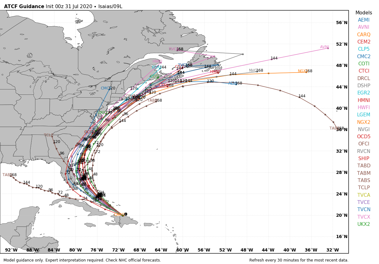
Once Isaias gets into the northwestern Bahamas, things get a bit trickier. A large high pressure area in the western Atlantic, and a trough of low pressure moving into the eastern United States will help to steer Isaias more towards the north-northwest, and then north, and eventually northeast. Exactly when those turns occur is critical to the forecast.
The current forecast calls for Isaias to make the northward turn east of Florida, sparing the Sunshine State from the worst of the storm. It may be close enough to bring some gusty winds and heavy rain to east-coastal Florida over the weekend, which is why the Tropical Storm Watch has been issued. That watch will likely be extended farther north on Friday. After that, it will head towards the Carolina coastline late Sunday into Monday. This is where the uncertainty is magnified.
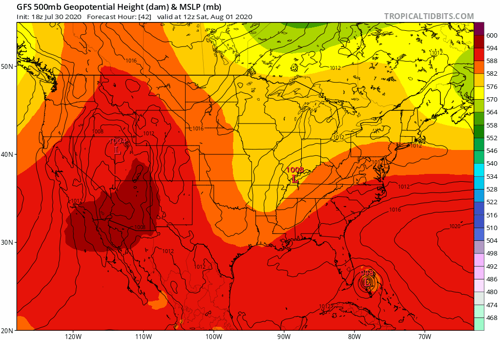
If the Western Atlantic high is stronger than currently expected, or if the trough moving into the East is sharper than the models are currently showing, then Isaias will continue northward, likely moving across eastern North Carolina. A weaker high or flatter trough, would allow for a more northeastward movement, which could allow Isaias to only graze the Outer Banks or possibly even miss them completely.
Once the storm is beyond the Carolinas, there is more uncertainty with its track. Again, a more northeastward motion will bring the storm out to sea with little additional impact. A motion that is more toward the north-northeast or even north, would increase the threat to parts of the Northeast, including New England for late Monday or Tuesday. As this point, coastal residents from Florida to New England should all keep tabs on the storm’s progress, as it could impact a large stretch of coastline this weekend and early next week.
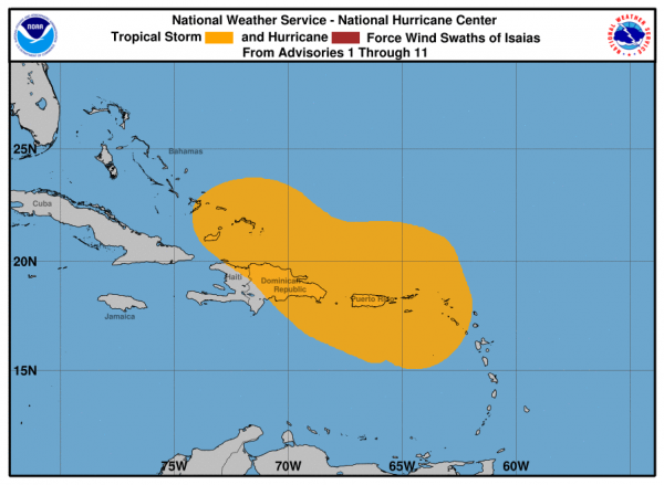
Isaias was well-advertised by the models for almost a week before it finally developed over the eastern Caribbean on Wednesday. It has produced wind gusts of up to 60 mph and heavy rain that produce flooding across parts of the Virgin Islands, Puerto Rico, and the Dominican Republic. Wind gusts as high as 54 mph have also been reported in the Turks and Caicos Islands this evening.