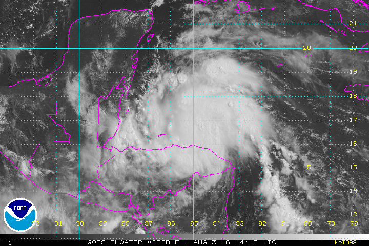
After a quiet July across the Atlantic Ocean, August began with Tropical Storm Earl forming southwest of Jamaica on Tuesday. Earl strengthened into a Hurricane Wednesday afternoon while approaching Central America, with landfall expected in Belize around midnight.
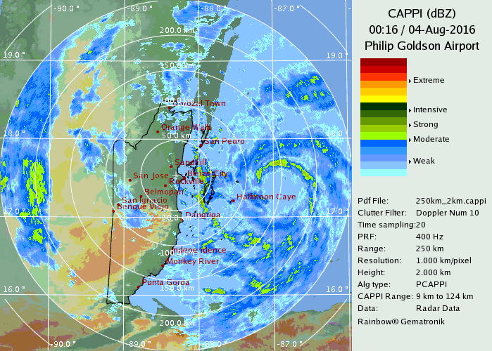
As of 10pm CDT, Hurricane Earl was centered about 40 miles east of Belize City, moving towards the west at 15 mph. Maximum sustained winds are near 75 mph, with little additional strengthening expected in the next few hours before Earl makes landfall.
Hurricane warnings are in effect from Puerto Costa Maya, Mexico southward to the Belize/Guatemala border. A Tropical Storm Warning is in effect from Puerto Costa Maya to Punta Allen, Mexico.
Most of the strong winds are in the northeastern quadrant of Earl, which will spare coastal locations in Honduras and Belize from significant wind damage. Right along the immediate coast, a storm surge of 4-6 feet, along with large waves will result in coastal flooding, especially near and north where the central makes landfall in Belize. The biggest threat by far is flooding and mudslides from torrential rainfall. Rainfall totals of 10-15 inches, with isolated totals in excess of 20 inches, are expected across Belize, Guatemala, and southeastern Mexico over the next few days.
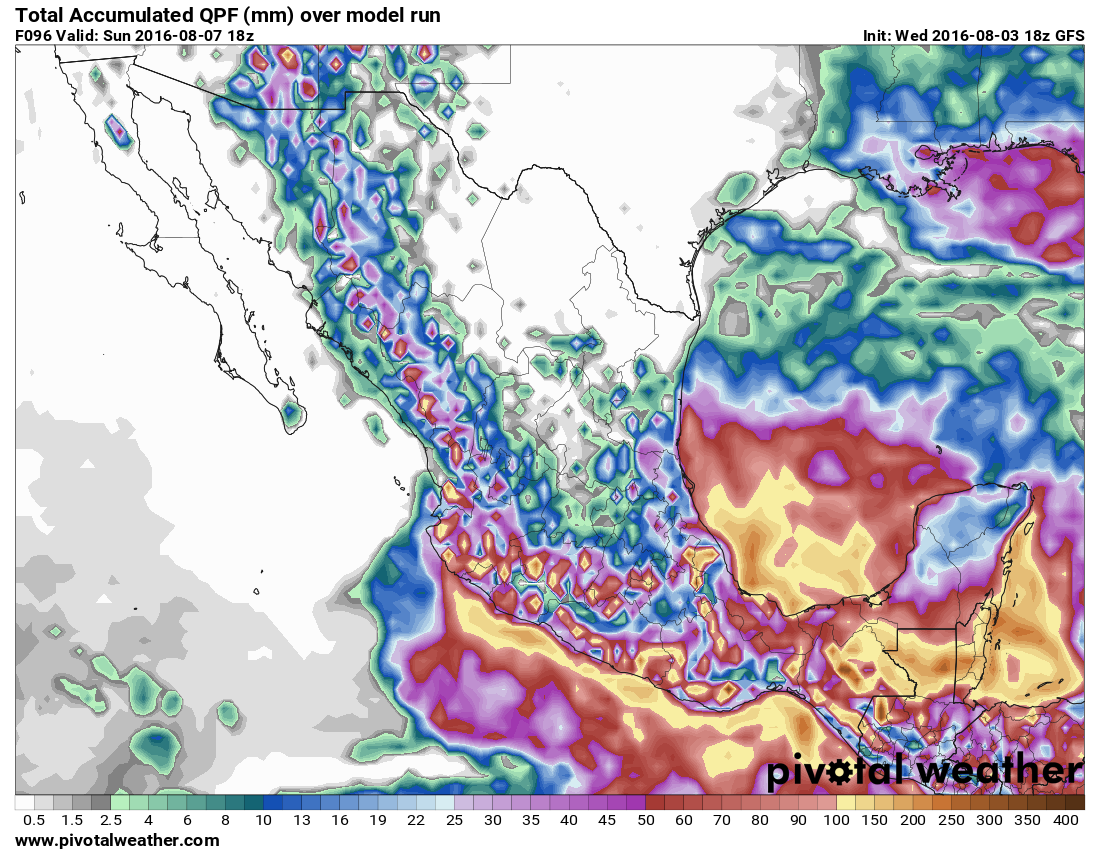
Once Earl moves inland, it would steadily weaken, likely being downgraded to a tropical depression by Thursday night. Earl should continue on a westward track, but the exact track will be critical for Earl’s future. If Earl remains over land, it will dissipate over southern Mexico. However, if the center can emerge in the southern Bay of Campeche, it could regain a little strength before making landfall again in Mexico.
Elsewhere in the Atlantic, things are mainly quiet. A tropical wave will bring showers and thunderstorms along with some gusty winds to the Lesser Antilles late Thursday, moving across the Virgin Islands and Puerto Rico Thursday night and Friday. Further development isn’t expected at this time.
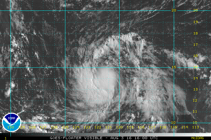
Meanwhile, in the Eastern Pacific, Tropical Storm Ivette continues to gather strength this evening. As of 11pm EDT, Ivette was centered a little more than 1000 miles west-southwest of Cabo San Lucas, Mexico, moving toward the west at 16 mph. Ivette has maximum sustained winds near 45 mph, and additional strengthening is expected. Ivette could become a hurricane in the next day or two while moving over open waters in the Eastern Pacific.