Over the past few months, there has been consistent troughing over the United States, particularly in the Great Lakes region, which has led to a stormier pattern across the eastern half of the country. One factor that can influence these changes in storm patterns and consistency is teleconnections.
Teleconnections are relationships between specific weather phenomena at locations often separated by considerable distances. These phenomena are correlated with particular climate patterns spanning thousands of miles and exhibit variabilities ranging from days to years. Some of these patterns can also have more significant impacts during specific seasons, while others affect the climate pattern throughout the year.
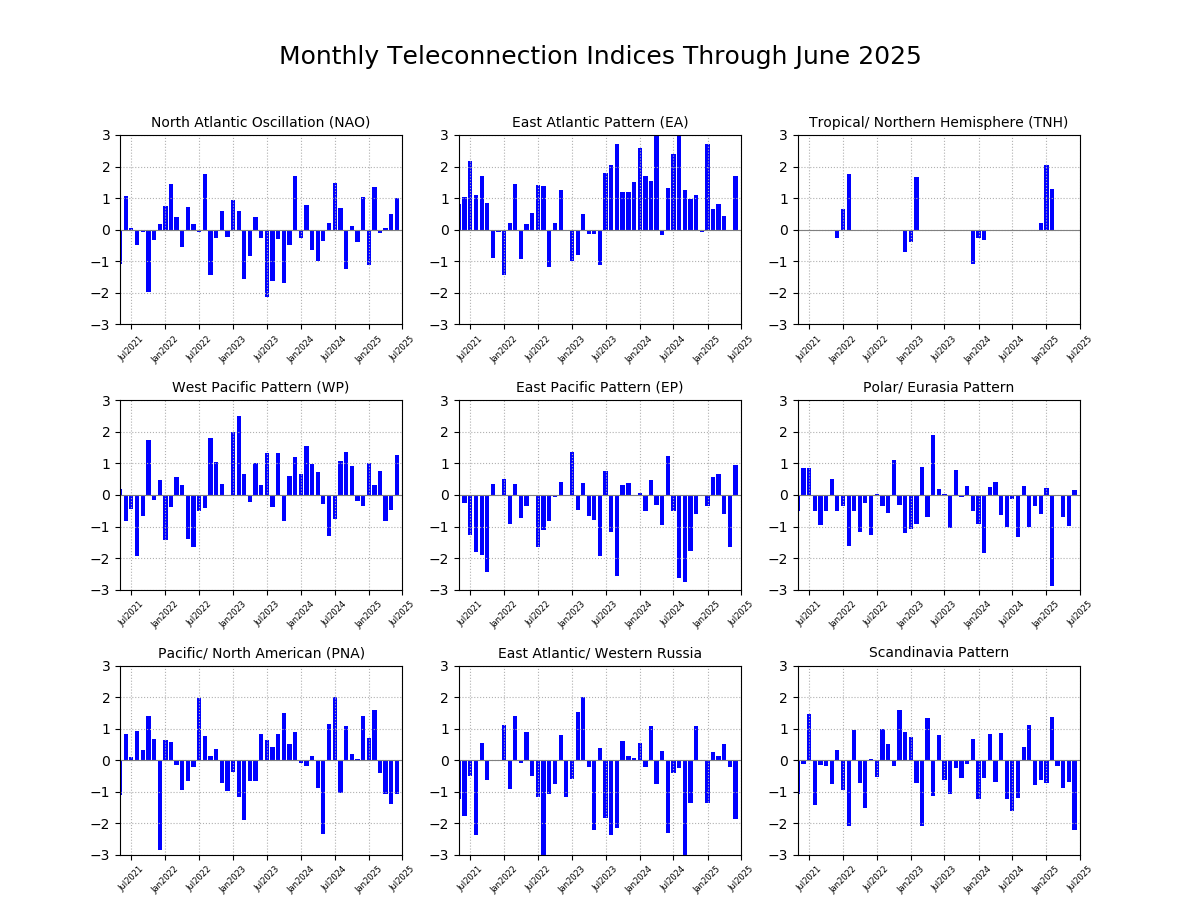
Some of the major teleconnections and patterns that affect North America include the Arctic Oscillation (AO), El Niño/Southern Oscillation (ENSO), East Pacific Pattern (EP), North Atlantic Oscillation (NAO) , Pacific/North American Pattern (PNA), and Madden-Julian Oscillation (MJO). Patterns like ENSO will have a lesser impact on intraseasonal climate variability, as it can take several months to transition between phases. In contrast, the NAO will have a greater impact, as it can change between phases on a more regular basis.
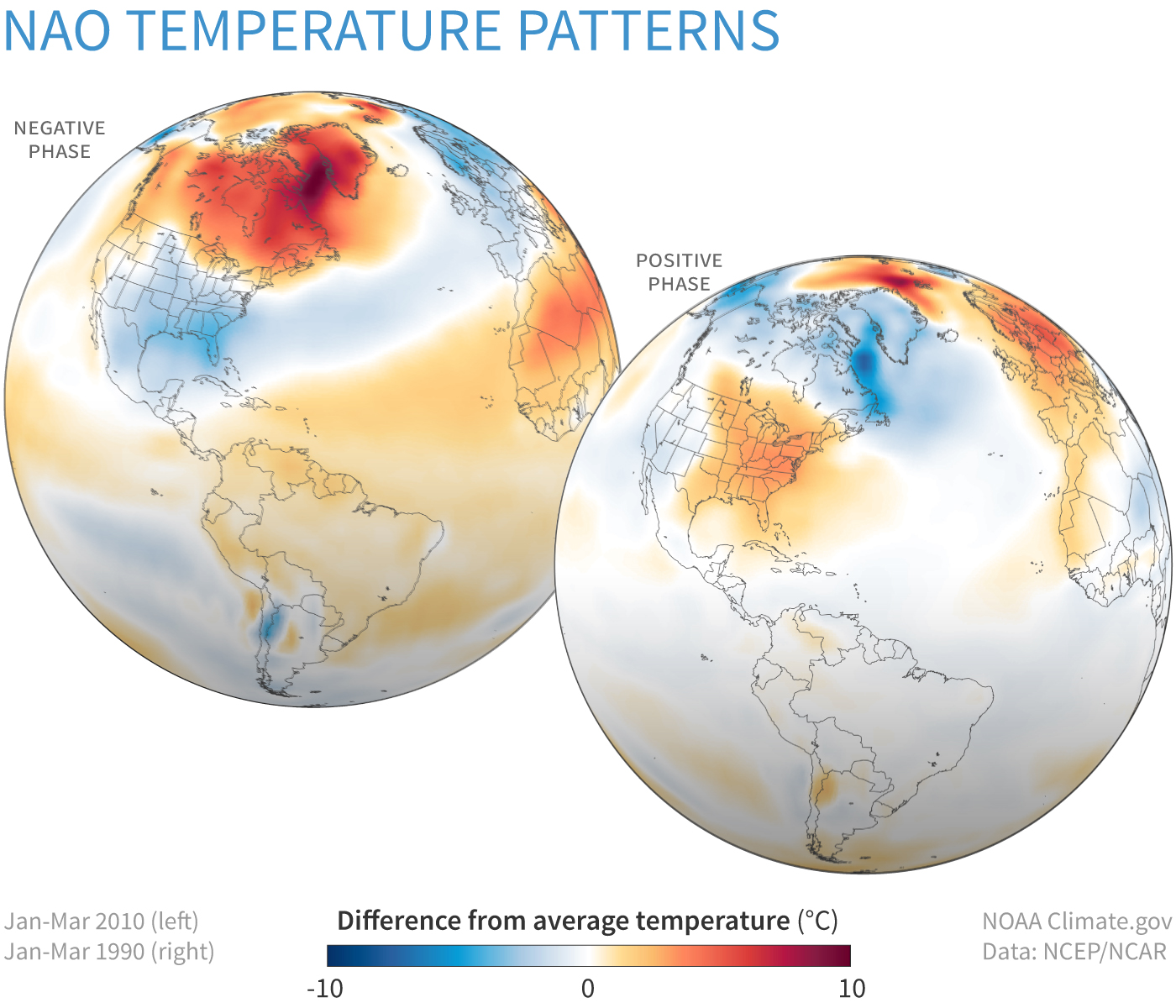
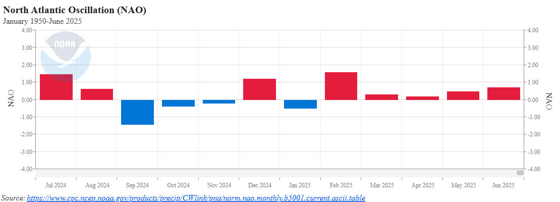
The NAO is an oscillation that impacts the climate pattern throughout the year. The positive phase will generally bring above-normal temperatures with a drier pattern to the Eastern United States, while the negative phase will produce the opposite. In the winter, a negative NAO usually leads to blocking over Greenland, and an increasing chance for more potent storms off the East Coast. The NAO has been mainly in the positive phase since early 2025. Although this may mean dry and warm conditions, the spring of 2025 averaged above normal for both temperature and precipitation across the eastern United States.
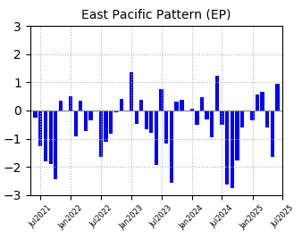
When examining other teleconnection patterns to identify the potential origins of the persistent unsettled pattern, it can be noted that the East Pacific Pattern transitioned into its positive phase in June, following a predominantly negative phase, especially over the past year. When the East Pacific Pattern is in its positive phase, the Eastern United States will experience more cyclonic activity, i.e., the persistent troughing we’ve been seeing across the Great Lakes and into the Eastern United States over the last several weeks.
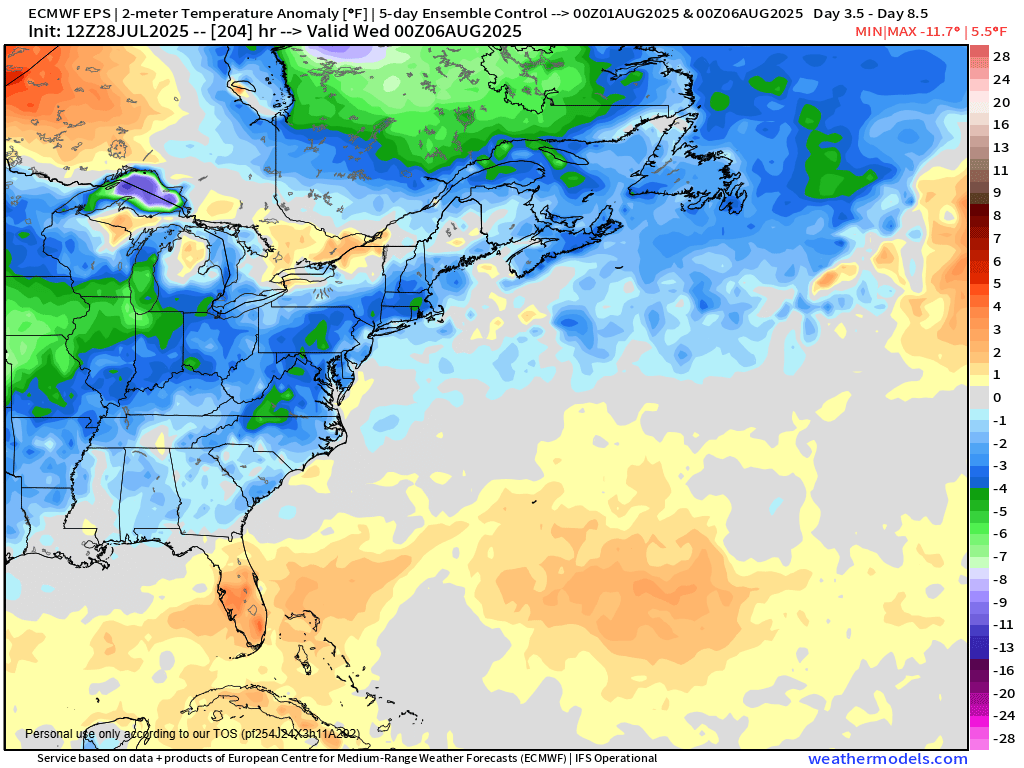
The stormy pattern is expected to continue across the East this weekend, as the NAO is expected to turn negative again, and a large trough of low pressure will settle into the Northeast. After a couple of hot and humid days for the first half of the week, a strong cold front will cross the region late Wednesday and Thursday before stalling out across the Mid-Atlantic states. Behind the front, temperatures will be as much as 5-10 degrees below normal for the end of the week and into the start of next week.
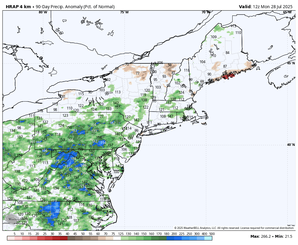
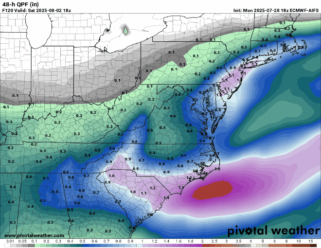
Along with the cooler weather, the potential exists for more heavy rain and flooding in parts of the Mid-Atlantic states and Northeast. As that front stalls out, a wave of low pressure will ride along it Thursday into Friday. With plenty of moisture in place in the tropical atmosphere south of the front, the wave of low pressure will produce heavy rain and thunderstorms. Some models show the potential for 3-6 inches or more of rainfall in spots in the span of 24-36 hours. Where the heaviest rain falls will be determined by where the front stalls out and the wave rides along it, which is still uncertain at this point.
This pattern has the potential to produce other issues as we head deeper into the summer. The tropics have been mostly quiet thus far, but we’re approaching the time of year when activity ramps up. The bulk of storms in the Atlantic form between mid-August and mid-October. While many storms will end up recurving and heading out to sea before impacting the United States, an East Coast threat becomes a little more likely with an upper-level trough of low pressure in the Midwest or near the Appalachians.