The “Dog Days of Summer” have arrived, with heat and humidity across a large part of the nation. Meanwhile, severe weather is possible across the Midwest on Friday.
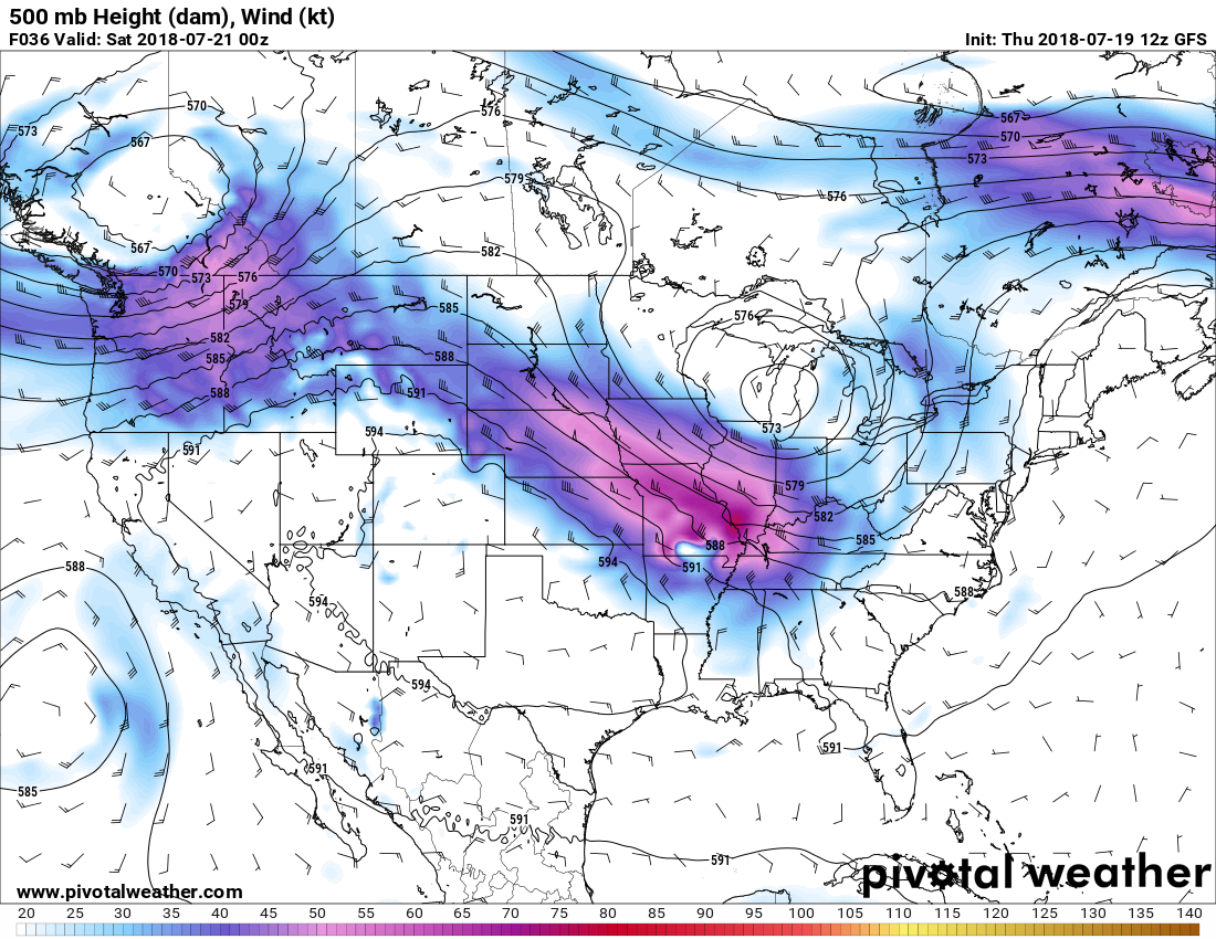
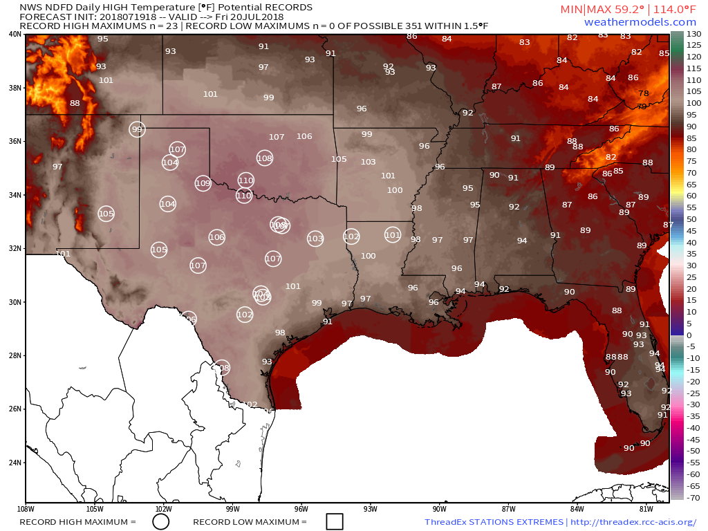
A weather pattern that is both typical and atypical of summer at the same time is going to settle into the nation over the next several days. The typical part is that we’ll have a ridge of high pressure off the East Coast, and another one in the Southwest. The ridge off the East Coast will result in heat and humidity up and down the coastline for the next several days. The ridge in the Southwest will bring very hot conditions to the Southwest and especially the Southern Plains, where record highs are expected over the next several days. The Atypical part is across the Midwest. Normally, in between the two ridges of high pressure you’d have a trough of low pressure, but in this case, we actually have a closed upper-level low pressure system. While these are common in the fall, winter, and spring, they usually don’t occur much in the summer. This will bring cooler than normal conditions into the Midwest for the next few days.
While hot weather is expected across Texas and the Southwest during the summer, the ridge of high pressure that is currently setting up across the region will bring in temperatures that are well above normal. In fact, record highs are expected for the next several days across much of Texas, as temperatures soar past 100 across much of the state, with some locations possibly exceeding 110 degrees. The heat won’t be confined to the Lone Star State, with triple-digit highs also expected from parts of the Lower Mississippi Valley into the Southern Plains as well as parts of Colorado and New Mexico. There won’t be much, if any, relief at night either, as low temperatures will stay in the 70s, with many locations, especially urban areas like the Dallas-Fort Worth Metroplex likely not dropping below 80 degrees for low temperatures.
As we head into next week, the heat will ease a bit across Texas and the Southern Plains, but the core of the intense heat will shift westward into the Desert Southwest. High temperatures will top 110 degrees across much of the area for the first half of next week, with the usual hot spots such as Lake Havasu City, Arizona; Laughlin, Nevada; and Death Valley, California likely exceed 120 degrees during some of the afternoons. Highs will also top 100 across much of interior California once again.
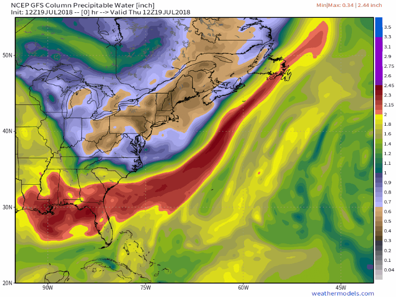
While the Texas and the Southwest deal with extreme heat, the East Coast will get a little bit of relief from what has been a hot start to summer. While temperatures will still be a little above normal this weekend into much of next week, highs will only be in the 80s to lower 90s. While the temperatures won’t be that bad, humidity levels will. With high pressure anchored off the East Coast, a southerly flow will help moisture stream northward from the tropics right up the East Coast this weekend and into much of next week. Dewpoints will be in the upper 60s and 70s across the region, so even though temperatures may not be hot, it will feel oppressive across much of the region.
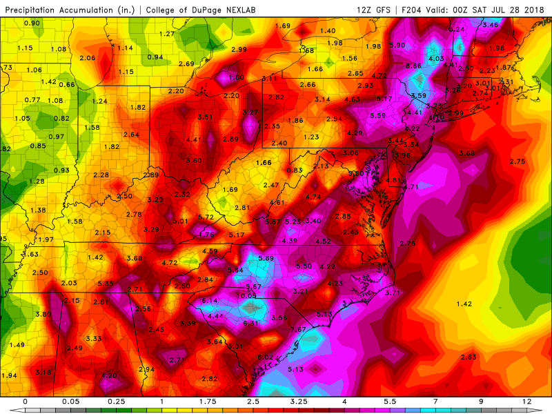
With a warm and humid airmass in place for much of the week, it won’t take much for showers and thunderstorms to develop each day. With plenty of available moisture, some of these storms will end up producing very heavy rainfall. While the map above is a forecast that shows widespread coverage of heavy rain, in many cases, the storms will be very localized. Some locations could get hit by slow-moving thunderstorms over and over, while other spots a few miles away get little to no rainfall. Across the Mid-Atlantic States, where heavy rain led to flooding during the Spring, similar conditions are possible again for the next week. Across the Northeast, things are a little different.
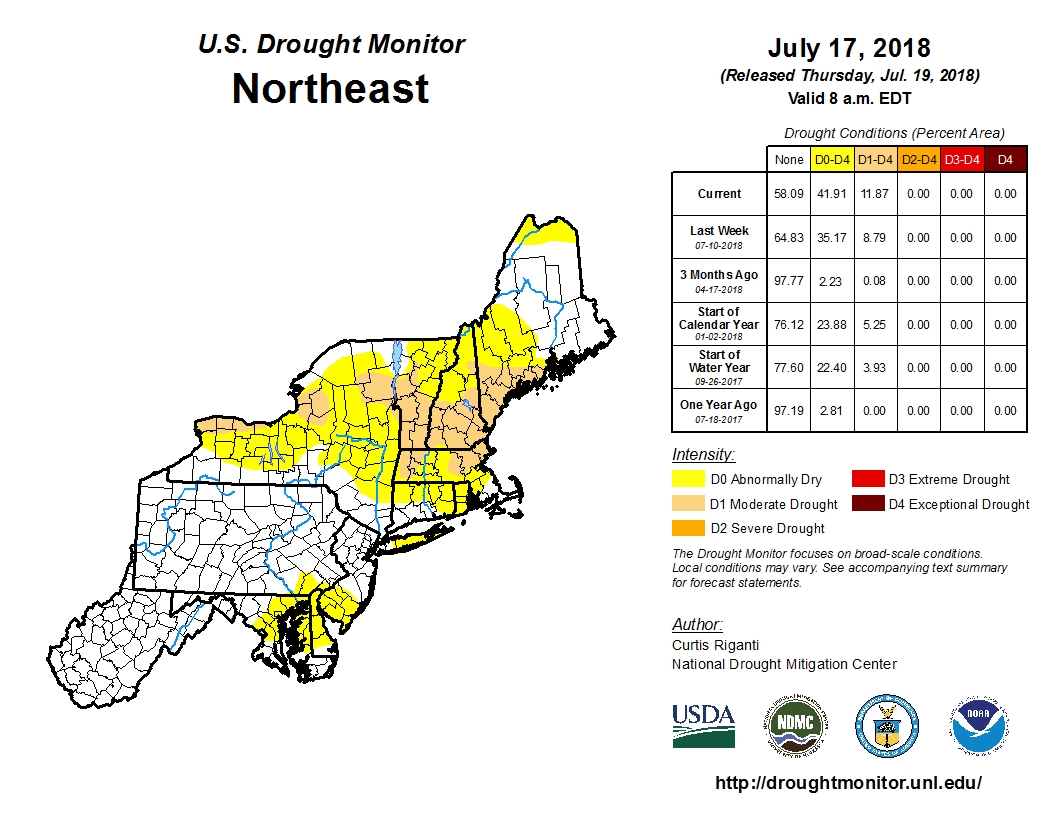
Much of the Spring has been very dry across New England and New York. Localized thunderstorms have brought heavy rain to a few spots, especially earlier this week, but overall, rainfall has been well below normal across the area. Some relief will come this weekend. A weak low pressure system will move across the region late Saturday into Sunday as an upper-level low pressure system moves into the Midwest. The surface low will bring heavy rain and some gusty winds to parts of Southern New England and southeastern New York. The heaviest rain is expected late Saturday night into early Sunday morning, so neither day should be a washout. Once that system moves by, a warm and humid airmass will settle in, with a daily chance for showers and thunderstorms this week.
This pattern is expected to remain in place through at least next weekend and possibly even longer. While none of the models are showing development of any systems in the tropics right now, this is the type of pattern that is conducive to storms impacting the East Coast. The tropics have been fairly quiet so far this season, and a relatively quiet season is expected, especially compared to last year. However, should something develop in or near the Bahamas, it wouldn’t take much for it to impact the East Coast with relatively little lead time. In 1991, a tropical depression developed in the Bahamas on August 16, 48 hours later it was a Category 3 Hurricane named Bob brushing the Outer Banks of North Carolina before slamming into Southern New England as a Category 2 storm 12 hours after that.
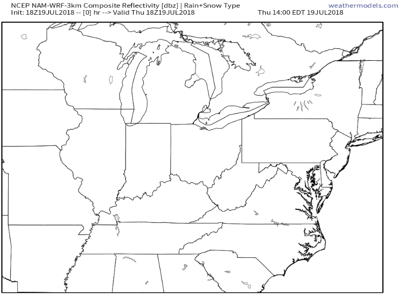
While Texas bakes and the East Coast sweats, an upper-level low pressure area will settle into the Midwest. With the clash in airmasses along a cold front, showers and thunderstorms will develop. Some of these storms will become strong to severe on Friday, especially across the Ohio and Tennessee Valleys. The main threats with any storms that develop will be strong winds, large hail, and torrential rainfall that could trigger flash flooding. Some tornadoes are also possible. The storms may start during the morning closer to the Great Lakes, with the afternoon and evening seeing the most widespread activity across the region. While activity should weaken at night, the threat of severe weather will continue across southern and eastern parts of the region.