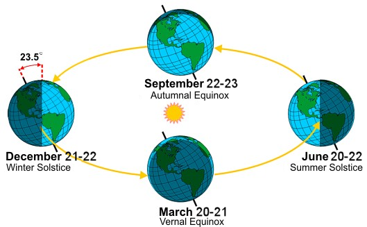
The summer solstice occurs at 10:41pm Friday, marking the official start of astronomical summer in the Northern Hemisphere. Summer weather will arrive along the East Coast just before that.
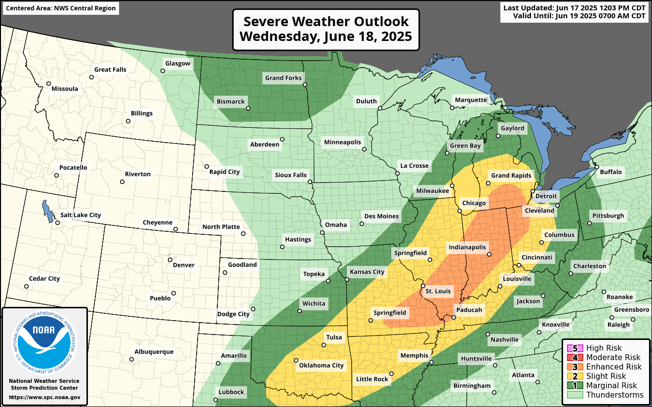
A frontal system extending from the Great Lakes into Southern Plains will slowly make its way eastward over the next few days. Ahead of the front, warm and humid air will result in an unstable atmosphere, with showers and thunderstorms developing. This front produced severe weather on Tuesday from the Front Range of the Rockies into the Central and Southern Plains, and severe thunderstorms will likely be more widespread on Wednesday from the Southern Plains into the Great Lakes. Some of the stronger storms may produce damaging winds, large hail, torrential downpours, and tornadoes, especially across parts of the Ohio Valley.
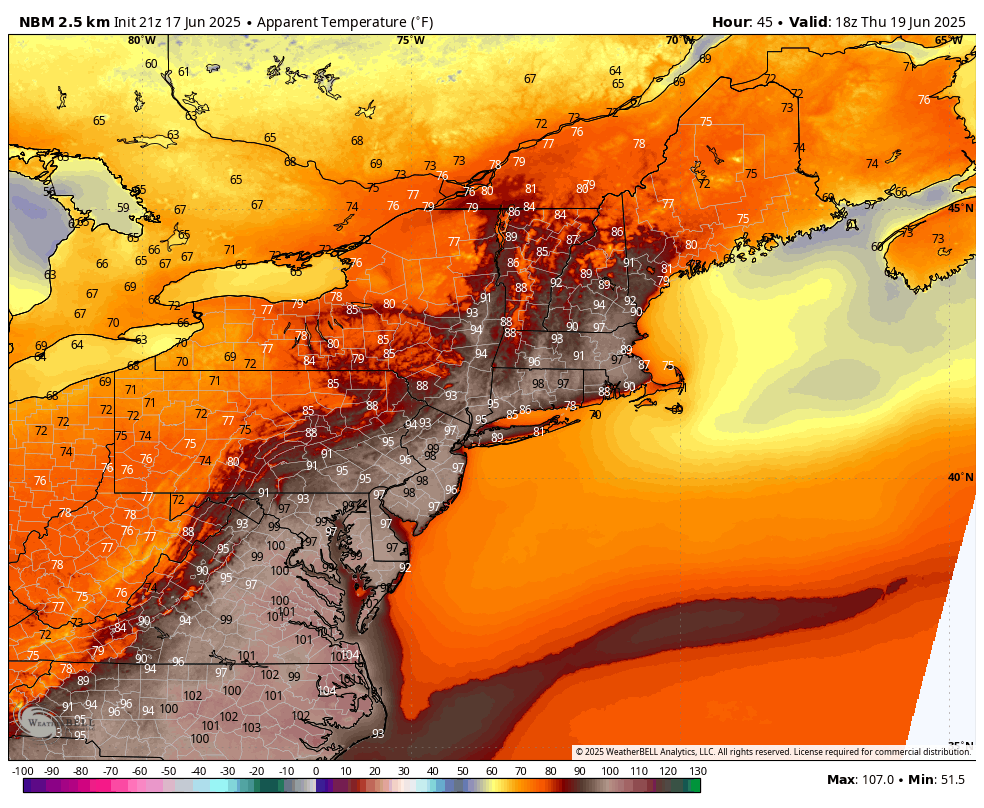
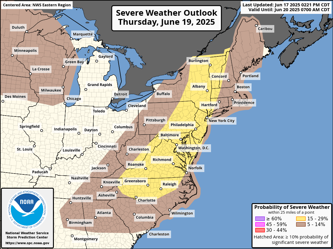
The front will continue marching eastward, heading toward the East Coast on Thursday. Ahead of the front, hot and humid weather is expected, especially along the heavily-populated I-95 corridor. For parts of the Northeast, especially from the New York City area into Southern New England, this could be the first time the mercury reaches 90 since August 28, 2024. For areas farther south, from Philadelphia into North Carolina, temperatures already reached or exceeded 90 at least once this year but could get into the middle 90s on Thursday. Accompanying the heat will be humid conditions, with dewpoints getting into the 70s for much of the region. This will result in heat indices in the middle to upper 90s for many areas, possibly over 100 from Washington southward to North Carolina.
Luckily, the heat and humidity will be short-lived. The aforementioned cold front will move into the region during the afternoon and evening, producing more showers and thunderstorms, some of which could be strong to severe. The timing of the front will help determine where the strongest storms develop, but the main threats with any storms that do form are damaging winds, heavy downpours, and hail, with a few tornadoes possible.
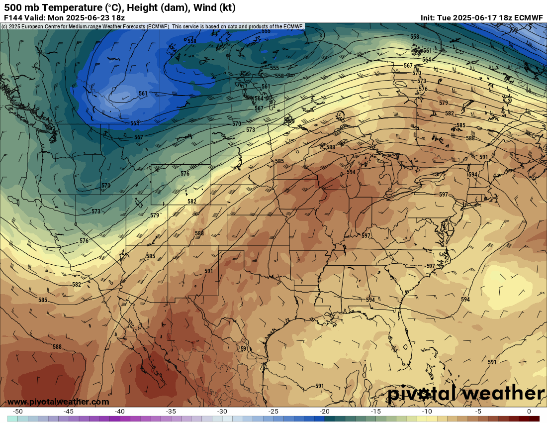
Drier weather settles into the East behind the front for Friday and Saturday, though temperatures will remain near to above normal. There’s a good chance that much of the Northeast will see its streak of 13 consecutive Saturdays with rainfall finally come to an end, but that is not guaranteed yet. Some models are showing the potential for a cluster of thunderstorms to develop in the Northern Plains Friday night, then race across the Northern Great Lakes and into parts of Northern New York and New England by Saturday night. Beyond that forecast models are showing the potential for a ridge of high pressure to settle into the East Coast for the first half of next week, resulting in an extended period of hot and humid weather.