On average, the peak of hurricane season in the Atlantic is the middle of September. Right on cue, the 2020 season has seen a significant uptick to activity, with four active systems, and possibly a fifth one a few days from now.
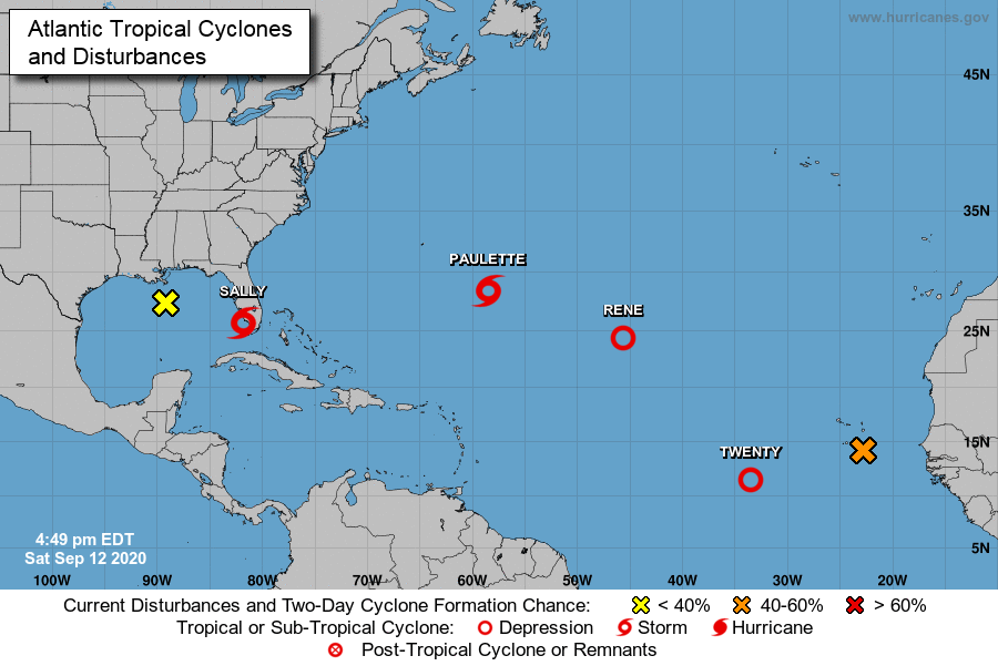
The most immediate threat to the US is Tropical Storm Sally. Tropical Depression 19 formed Friday evening just off the coast of southeastern Florida. The center of the system moved inland Friday night just south of Miami, producing wind gusts of up to 50 mph and heavy rain across south Florida. Early Saturday afternoon, the depression had strengthened into Tropical Storm Sally, and by late afternoon was centered about 30 miles south-southwest of Naples, Florida, moving toward the west at 7 mph. Maximum sustained winds were near 40 mph.
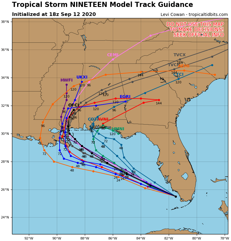
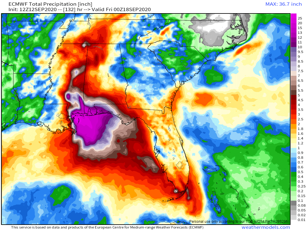
Sally is expected to track northwestward across the Gulf while strengthening over the weekend. The current forecast has it strengthen into a hurricane by Monday, but conditions could be favorable for it to intensify even faster. Current forecasts call for landfall in either southeastern Louisiana or southern Mississippi late Monday night or early Tuesday. While storm surge and strong winds will obviously be a threat, rainfall will be the most significant issue residents of the Gulf Coast will need to prepare for. Sally will be a slow-mover, and could even stall out near or just after landfall. We’ve seen plenty of slow-moving tropical systems dump torrential rainfall on places in recent years, and this system will likely do the same. Rainfall totals of 10-20 inches and possibly heavier will create widespread significant flooding.
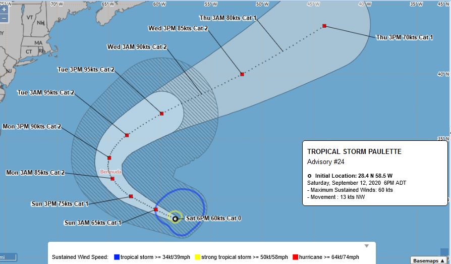
Tropical Storm Sally isn’t the only storm that is threatening land at this time. Tropical Storm Paulette is centered about 460 miles southeast of Bermuda this afternoon, moving toward the northwest at 15 mph. It has maximum sustained winds near 70 mph, and it will likely become a hurricane tonight. Additional strengthening is likely over the next couple of days as the storm continues northwestward before turning more toward the north. Unfortunately, that northerly turn will happen right around the time that Paulette reaches Bermuda’s longitude. A hurricane warning has been issued for Bermuda. Current forecasts call for the storm to pass very close to or right over the island late Sunday night and early Monday as a Category 2 hurricane. Paulette will also bring large waves to parts of the East Coast over the next several days, increasing the threat for rip currents at the beaches.
Bermuda is no stranger to tropical cyclones, as they are impacted by one per year on average. Last year, Hurricane Humberto produced wind gusts in excess of 120 mph on the island when the center passed just to the northwest. The last hurricane to make landfall in Bermuda was Hurricane Nicole in 2016. The only other storms to move directly across Bermuda in the 30 years before Nicole were Hurricane Fabian in 2003 and Hurricane Emily in 1987. One element of hurricanes that Bermuda doesn’t have to worry about is storm surge. Because the island is essentially a peak in the middle of the ocean, the water doesn’t have time to build up approaching the coast. The reef surrounding the island also helps to disperse some of the water before it reaches land. Humberto was a Category 3 storm that passed just northwest of the island last year, but only produced a storm surge of 2-3 feet. A similar storm impacting the US could produce a storm surge of 10-15 feet on average.
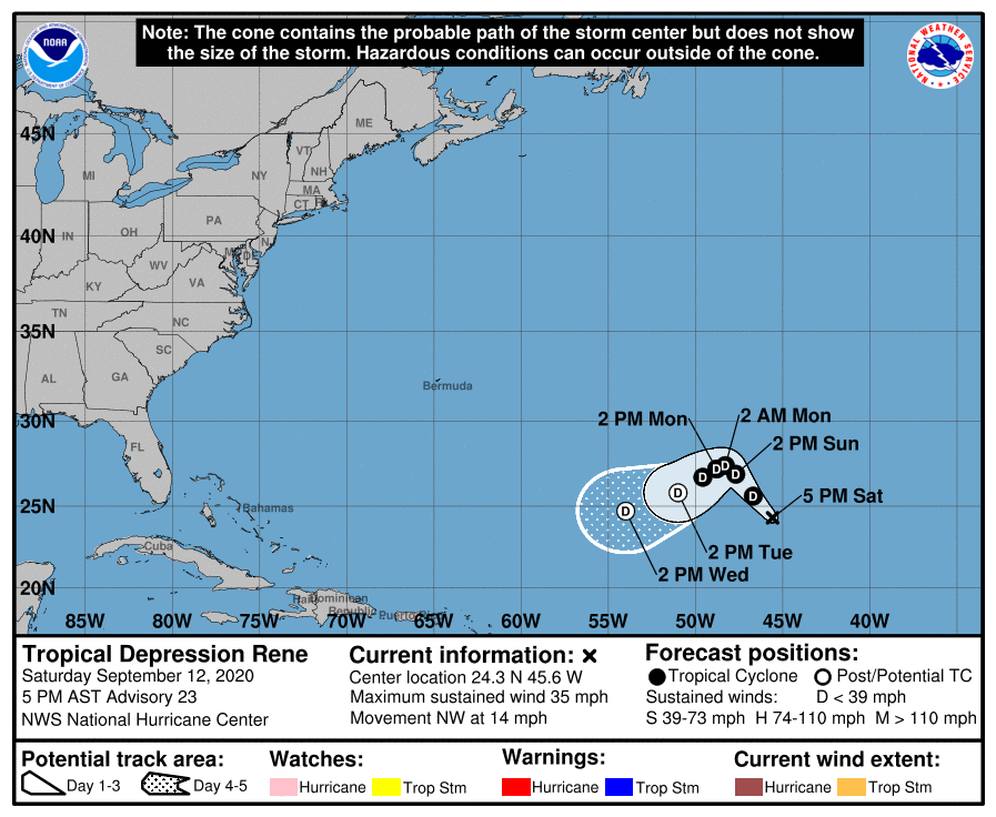
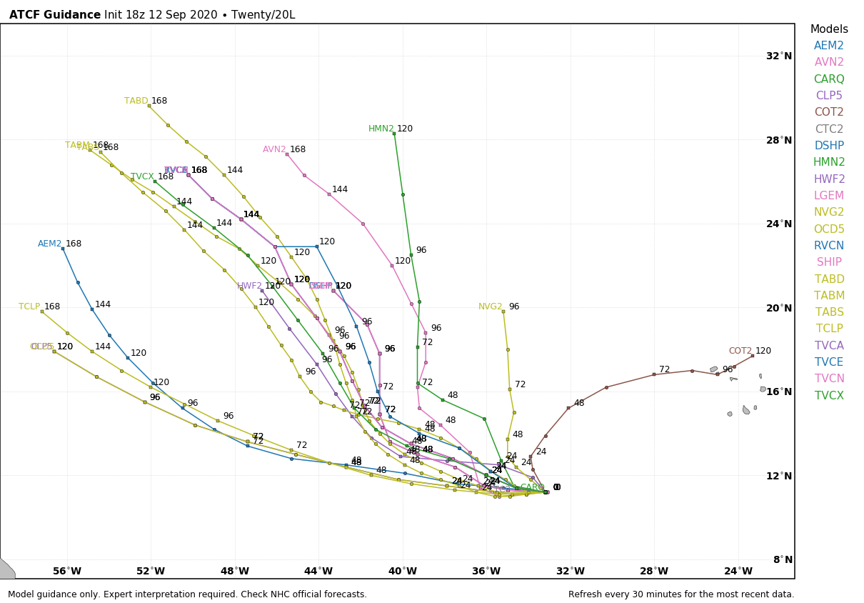
In the eastern Atlantic, Tropical Depression Rene is slowly weakening this afternoon. It is centered about 1200 miles east-northeast of the Lesser Antilles, and maximum sustained winds have decreased to near 35 mph. Rene is expected to remain weak while meandering around in the central Atlantic for the next few days. Conditions won’t be that favorable, and it will likely dissipate over open water by early next week.
Even farther to the east, Tropical Depression 20 has developed this afternoon. It is centered a little more than 2000 miles east of the Lesser Antilles, and is moving toward the west-northwest at 9 mph. Maximum sustained winds are near 35 mph, and additional strengthening is likely. It will likely become a tropical storm on Sunday, at which point it will be named Teddy. It is expected to continue strengthening while crossing the Atlantic over the next several days. It will not impact any land areas for at least another 5 or 6 days, if at all. Some of the models show the potential for this to become a significant storm, so we’ll keep an eye on it.
Another area of disturbed weather is crossing the Cabo Verde Islands this afternoon. It will bring squally conditions to the islands tonight. There is some potential for this system to develop over the next few days as well. Once it moves past the islands, it will likely not be a threat to any land areas, even if it does develop.