There’s an old saying in meteorology that goes “Droughts end in Floods”. That is likely to be the case over the next few days, as an extensive, and in some cases significant drought currently grips a large portion of the nation, but relief is on the way for some areas.
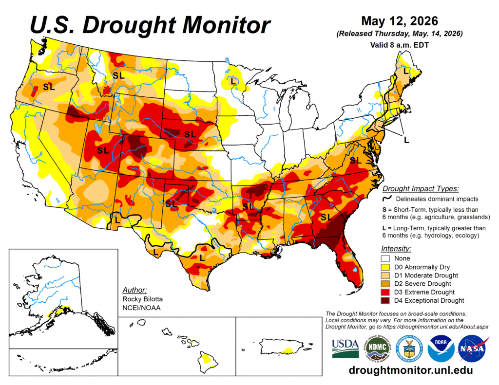
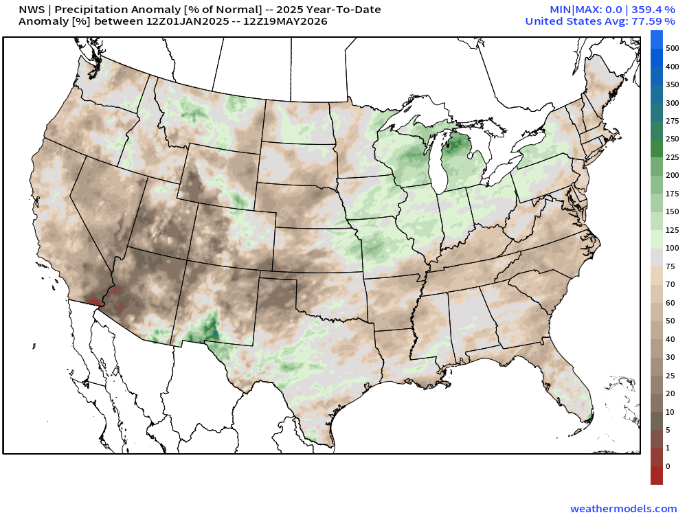
As is typical with a La Nina pattern that had been in place since last summer, dry weather was common for much of the southern tier of states over the past several months. Many locations from eastern Texas to the Southeast and up the East Coast are running precipitation deficits on the order of 6 to 12 inches or more over the past 6 months. This has worsened drought conditions in many areas, and created them in spots that weren’t that dry to begin with. That dry pattern is about to change.
A strong cold front extends from the Great Lakes to Texas this evening, and while the northern portion of the front will head eastward tonight and Wednesday, southern portions of the front will become stationary from Texas to the Carolinas over the next few days. With a southerly flow south and east of the front, moisture from the Gulf of Mexico will continue to flow northward, resulting in numerous episodes of showers and thunderstorms over the next several days from Texas to the Southeast.
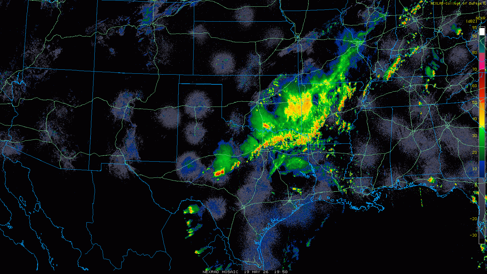
Strong to severe thunderstorms are already occurring across parts of Texas, and they will spread across much of the remainder of the Lone Star State this evening. With that front stalled out across central portions of the state for the next few days, waves of low pressure will ride along it, resulting in numerous episodes of heavy rain and thunderstorms. While severe weather is still possible along the tail end of the front in west Texas on Wednesday, heavy rain will be the main threat for the next several days. Between now and next Tuesday, much of southern and eastern Texas as well as nearby portions of Louisiana, Arkansas, and Mississippi could see as much as 4 to 8 inches of rain, with isolated totals to 10 inches or more possible. While this will wipe out the precipitation deficits, it will also result in flooding in many areas, especially urban areas like Houston where flash flooding is common during heavy rainfall.
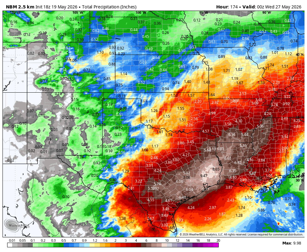
Farther east, drought conditions remain very problematic across parts of the Southeast, where wildfires have been a problem this Spring. While some rainfall will move in over the next few days, the bulk of the heavy rain will stay north of this area, with the front remaining stationary across the Tennessee Valley and the Carolinas. In these spots, rainfall will still be significant, on the order of 1-3 inches and locally heavier, over the next several days, but nowhere near what will fall across Texas and the Lower Mississippi Valley. Drought conditions persist in this region as well, so the rainfall will be welcome.
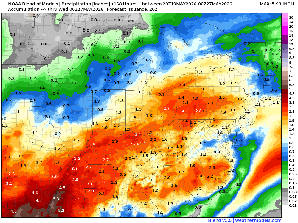
Heavy rainfall is also likely across parts of the Ohio Valley, likely resulting in flooding in some spots. This are has received persistent rainfall through the Spring, so drought it not an issue, and the heavy rain falling on ground that is already saturated, or near saturation will end up in flooding. Many rivers in the region are already near flood stage, especially across southern Indiana and southern Illinois, so the addition rain will send these rivers over their banks.