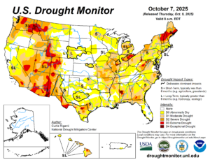
After several weeks of mainly dry weather from the Mid-Atlantic to the Northeast, many areas are experiencing abnormally dry to drought conditions, with some areas even seeing an extreme drought. A developing low-pressure system could bring some relief to areas.
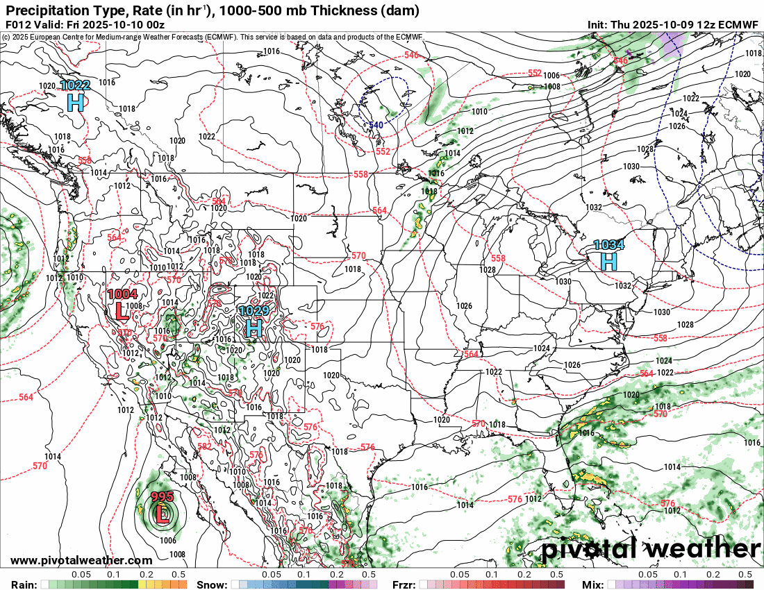
A system is developing off the coast of the Southeastern United States and is beginning to move north. At the same time, another smaller system is moving out of southern Canada and through the Great Lakes. By the end of the weekend, these two systems will combine near the Mid-Atlantic and progress toward New England.
As this system strengthens, it will bring the potential for strong and gusty winds from the Delmarva Peninsula to the southern coast of New England through the beginning of the week. This region still has most of its leaves on the trees, so these gusty winds could bring down the heavy trees, resulting in more widespread power outages.
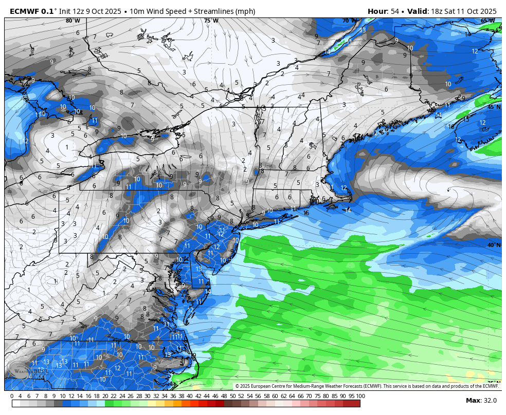
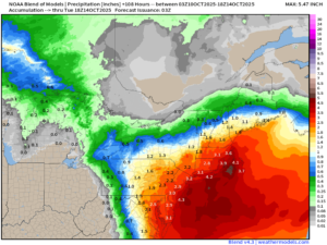
This system is also expected to bring heavy rain across the region. While much of the region is experiencing a drought and desperately needs rain, some areas, especially those closer to the coast, are at a higher risk of flooding. The greatest potential for flooding will be between Sunday afternoon and Monday night, with coastal flood watches and advisories already in effect spanning southern New England and the Mid-Atlantic. In combination with the highest rainfall totals near the coast, tides are still running higher than usual from the astronomical high tides that occurred earlier this week. Strong winds will also contribute to the formation of large waves offshore, creating a long fetch. The persistent east and northeast flow will allow these large waves in the long fetch area to move onshore, posing a greater threat to flooding in coastal areas, especially from Cape Cod to the northern Mid-Atlantic through Monday evening.
Impacts will begin to diminish Monday night as the system starts to pull away from the region before high pressure builds in behind over the Northeast and Mid-Atlantic, allowing for drier weather through at least the middle of the week.