As the Atlantic hurricane season moves into its typical peak season from August to November, one key factor is preventing a prime region of formation from looking likely to see much development: a very strong El Niño that is expected to persist through early spring.
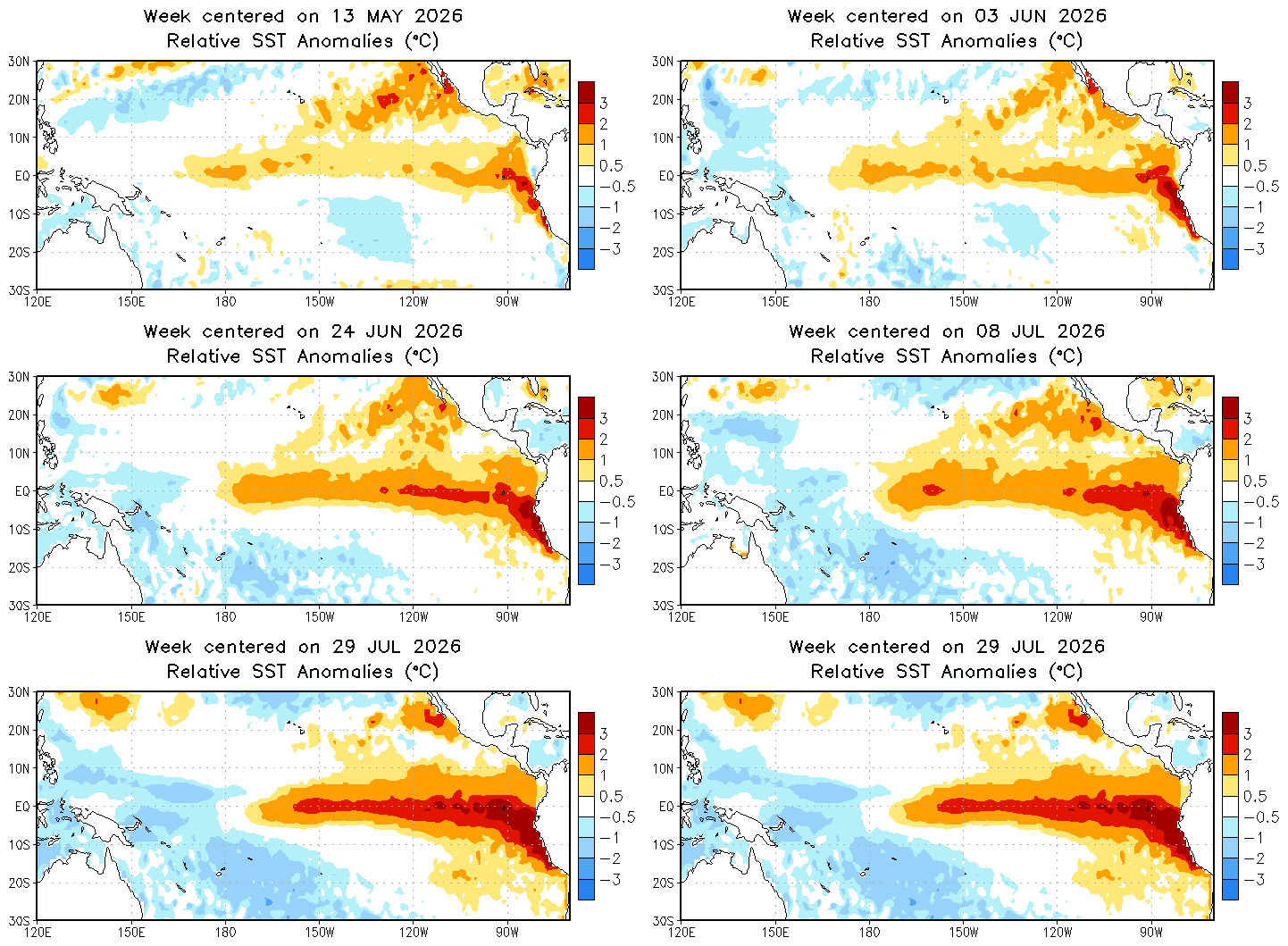
El Niño describes a warming of oceanic surface temperatures in the eastern Pacific along the equator. Typically detected as underwater movement below the ocean surface some time before it appears, it’s not officially declared until 3 months of warming have occurred, and it drastically changes how atmospheric currents behave. In El Niño, the primary upward motion in the Pacific occurs over the eastern Pacific, where El Niño is located. As a result, the primary downdraft occurs over the Eastern Atlantic Ocean.
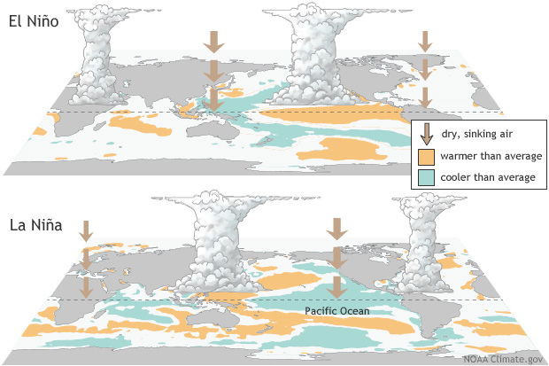
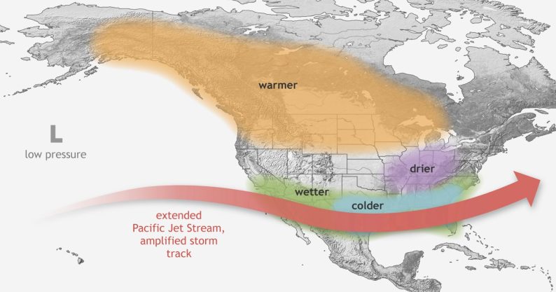
Additionally, El Niño strengthens the jet stream, keeping it southward and positioned over the Atlantic and the Gulf. As a result, wind shear over the Atlantic prevents most storm formation in the Gulf and the equatorial Atlantic, especially in later months.
This combination of factors creates atmospheric conditions that are incredibly unfavorable for tropical storms to form in the Gulf and Atlantic, especially at this time of year, where the most favorable zone is normally just north of South America and just east of the Caribbean. However, storms can still form off the East Coast of the United States. When they do, they typically take one of two paths. Out to sea, or moving north along the coast. Storm systems may still try to appear in the Atlantic and the Gulf, though most of them end up torn apart by the shear forces or never develop rotation, preventing them from becoming nothing more than a cluster of thunderstorms over the open sea that could arrive at the coast.
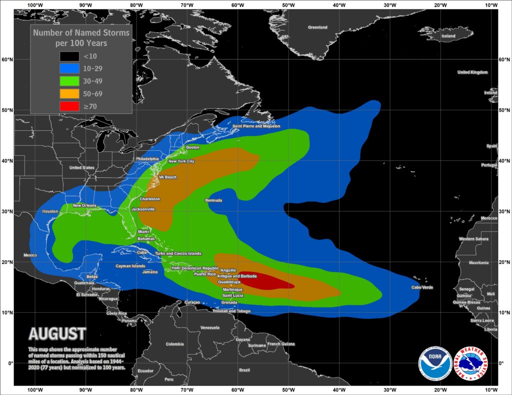
While wind shear may prevent major storm development, some systems do still break through. Systems such as these typically stay as clusters of thunderstorms rather than developing into tropical depressions or hurricanes. The real danger comes from storms that start to rotate, as these can develop into tropical storms or even hurricanes that then move along the coast or across Florida. One example of a hurricane that developed in this region before moving across Florida and into the Gulf is Hurricane Andrew in 1992. The season started slowly, as Andrew was not named until August 16, meandering in the central Atlantic before rapidly strengthening to Category 5 before making landfall.
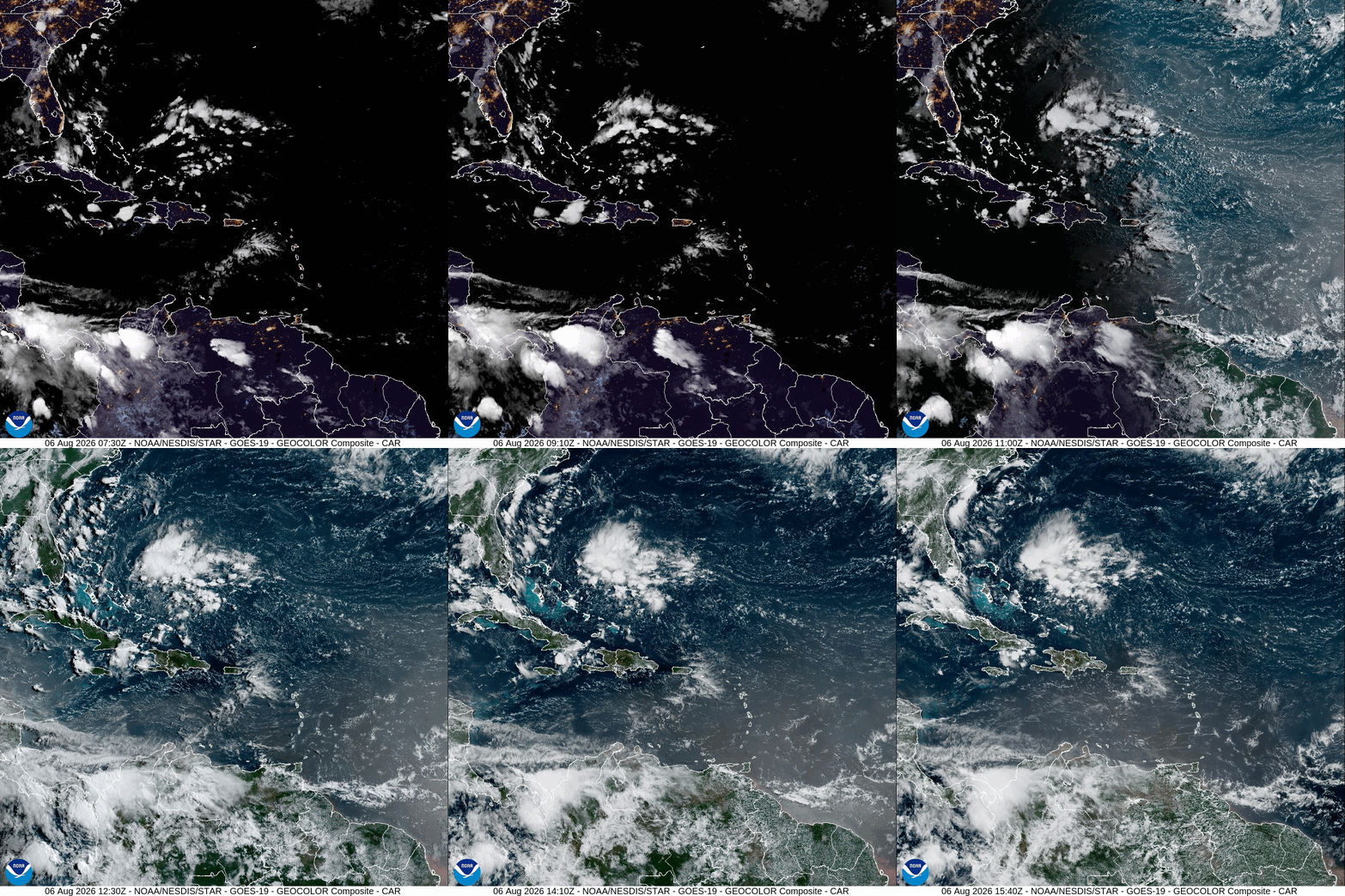
Storm systems may still develop in the Atlantic, but none will get very strong as wind shear caps development. Loop provided by NOAA.
As for how much wind shear there is currently, and why there are no storm developments expected in the Atlantic anytime soon, wind shear values are similar to those of the 2015 season, with the current season currently running as the second strongest wind shear across the Atlantic.
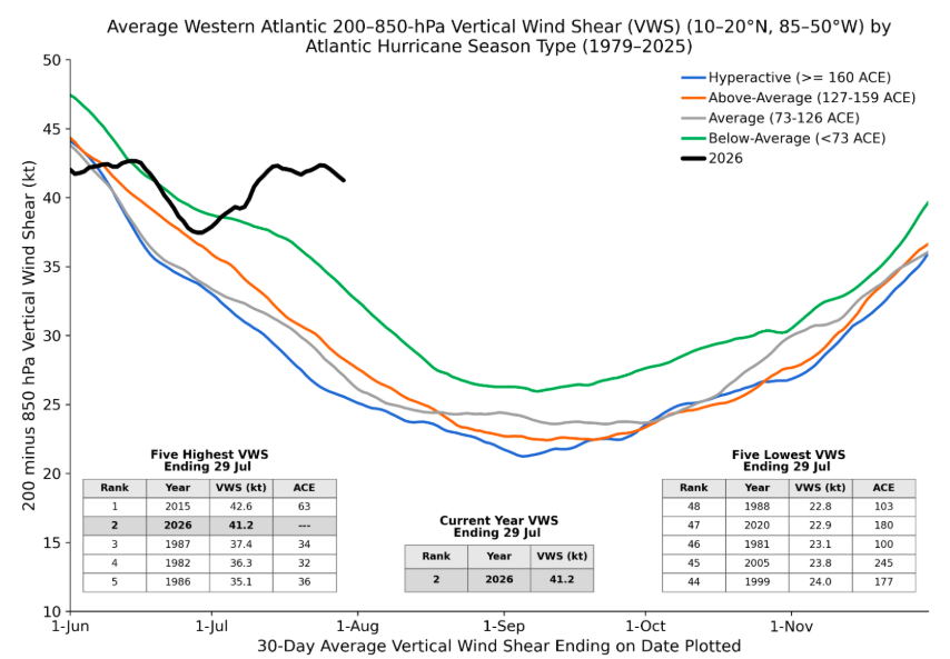
While the Atlantic may be looking to remain calm for the foreseeable future, as proven many times over the years, it only takes one storm for it to become an impactful hurricane season.