November can bring an array of weather to the U.S., from summer clinging to life in the south to snow starting to fall in the North. This fall has been particularly quiet and mild in many areas because of the ongoing super El Niño. The Southwest has been the exception, as remnants from tropical systems have brought heavy rain to the region. As we move through the first half of November, we can see a change in the pattern. One area to watch is the Northeast, where a series of systems could bring an unsettled stretch of weather.
Saturday (11/7):
A cold front moving offshore will end the morning rain along the East Coast, but a secondary disturbance in the Northeast will bring another chance of showers, mainly in the afternoon and evening. A front will remain stationary across the Gulf and will bring showers and thunderstorms to southeast New Mexico and western Texas. Some isolated showers are also possible across the Florida panhandle. A large system in the Pacific will move onshore near southeast Alaska and bring late-afternoon and overnight showers to the Pacific Northwest. Elsewhere, high pressure will bring dry weather from California to the Ohio Valley. However, the Heartland will see extra cloudiness as a frontal system extends out of Central Canada.
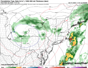
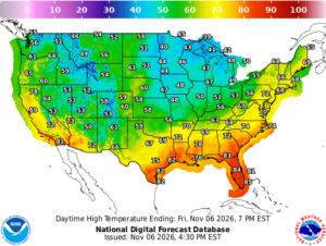
Most of the I-95 corridor will wake up to temperatures in the upper 40s to lower 50s, with Florida and the Gulf Coast in the mid-60s to mid-70s. Morning temperatures along I-5 will range from mid-40s to mid-50s. Southern California will reach only the low 60s. Interior areas will start the day in the 30s, except the Rockies, where temperatures could drop into the low-to-mid 20s. Much of the country will see highs in the upper 50s to low 60s. The Great Lakes are expected to be the coldest, with afternoon highs only reaching the upper 40s to low 50s. Florida, the Gulf Coast, California, and southwest Arizona will see the day’s warmest temperatures, with highs in the 80s.
Sunday (11/8):
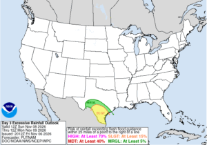
Little change is expected on Sunday as lingering showers from the aforementioned disturbance continue across the Northeast as the system slowly moves offshore. The stalled front across the Gulf will produce heavy rain and thunderstorms across southern and Western Texas, with isolated showers still possible across the Florida peninsula. Showers will come to an end in the Pacific Northwest as a low pressure system in western Canada moves inland and quickly dissipates as it interacts with the high that remains in place across North America. For the rest of the country, high pressure will bring dry weather and sunshine. However, a cold front stretched across the Upper Midwest and Northern Plains will bring clouds to the region.
The cool air will shift east by Sunday morning, with most of the country starting the day in the 30s. Those along the immediate coasts, Southern Plains, and the Southwest will see slightly milder temperatures, in the lower to mid-40s, and some areas will even stay in the 50s. Florida, the Gulf Coast, and Southern California will see the warmest morning lows, with temperatures only getting down into the 60s and low 70s. By the afternoon, temperatures will climb into the mid-to-upper 50s from New England to the Great Lakes. The mid-Atlantic to the West Coast will see afternoon highs in the mid-50s to mid-60s, with some areas possibly climbing close to 70. Florida, California, and southwest Arizona will be the hot spot once again, with temperatures returning to the 80s.
The Upcoming Week:
Unlike the last several weeks, this upcoming week could take an unsettled turn, especially across the northern part of the country, as a series of systems moving through central Canada send fronts through. A secondary cold front may bring another round of showers to the Northeast on Monday. The front will remain stalled across the Gulf through the middle of the week, creating potential for showers across parts of the Southeast. The Gulf of Alaska remains very active through the week, with a system expected to bring another round of rain to the Pacific Northwest during the first half of the week and another system at the end of the week. Otherwise, high pressure will dominate the weather through the week, keeping the rest of the country dry.
A weak low is expected to move out of Canada and through the central US before moving offshore around the Mid-Atlantic. Some models are developing this system into a coastal storm that could impact the Northeast toward the end of the week, possibly into the following weekend.
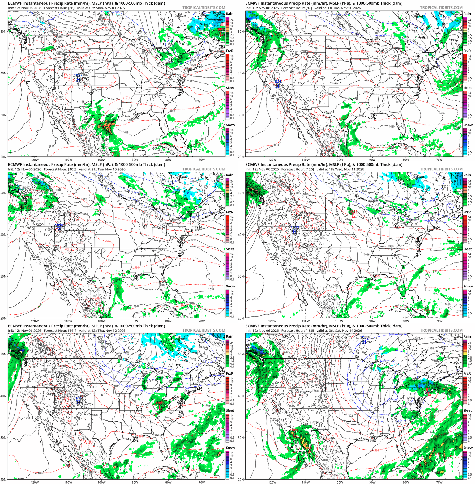
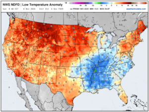
Temperatures will generally average above normal through the week. The central US, Rockies, and Intermountain West will enjoy well-above-normal temperatures for much of the week. In the east, temperatures will shift to below normal by the week’s end.