The weather pattern flips this week, bringing widespread rain and a high likelihood of flooding and flash flooding to the Northeast and Mid Atlantic.
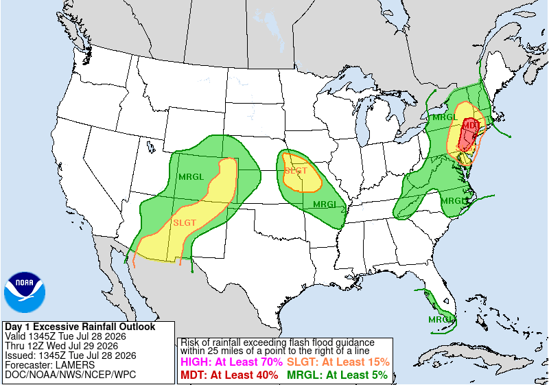
Through the 29th to the 31st of July, a strong surface low will move quickly over the northeast bringing signifigant rain across the region. On Tuesday the 28th, an upper level trough will redirect the surface low along its southern edge and off the coast as it develops into a strong cut off low – A low pressure system that is disconnected from the prevalent wind direction – that persists until Friday the 31st. While the system is moving from the west-northwest initially, the cut off low will redirect moisture from the great lakes to the southeast, before moving northward along the Atlantic coastline.
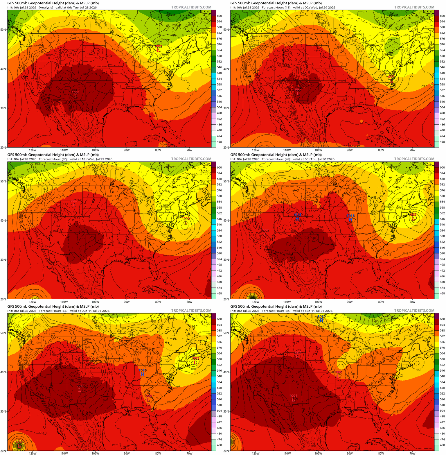
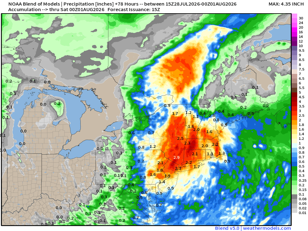
Once in place, this cut off low will remain through Friday the 31st, bringing rainfall totals between 2 and 5 inches in New York and western New England, and 1 to 3 inches further east. The movement of the surface low could see this heavy rain extend as far south as North Carolina, though the most certain area is focused around NYC and the surrounding states. Localized totals could potentially exceed 6 to 7 inches. The 29th will see most of the rainfall from this system as it sets up over the region, with follow up showers moving through eastern New England on Thursday and Friday.
As heavy rainfall progresses, storm drains could get overwhelmed as their capacity is exceeded. Underpasses and other low lying areas will be most suceptible to flooding as drains back up, and water levels could rise quickly. While most of this water will be standing water, it only takes a few inches for a car to become stranded. The water also wont necessarily be clean water, as ground debris is picked up by rainwater flowing into the now flooded area.