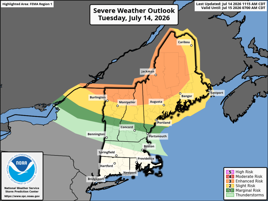
Severe weather doesn’t often make its way to the Northeast to the level that other regions of the country see. When it does, however, it generally comes from one of two directions, from the south along the coast, or from the northwest in southern Canada. The severe weather moving through today and tonight of July is one case of weather coming from the northwest.
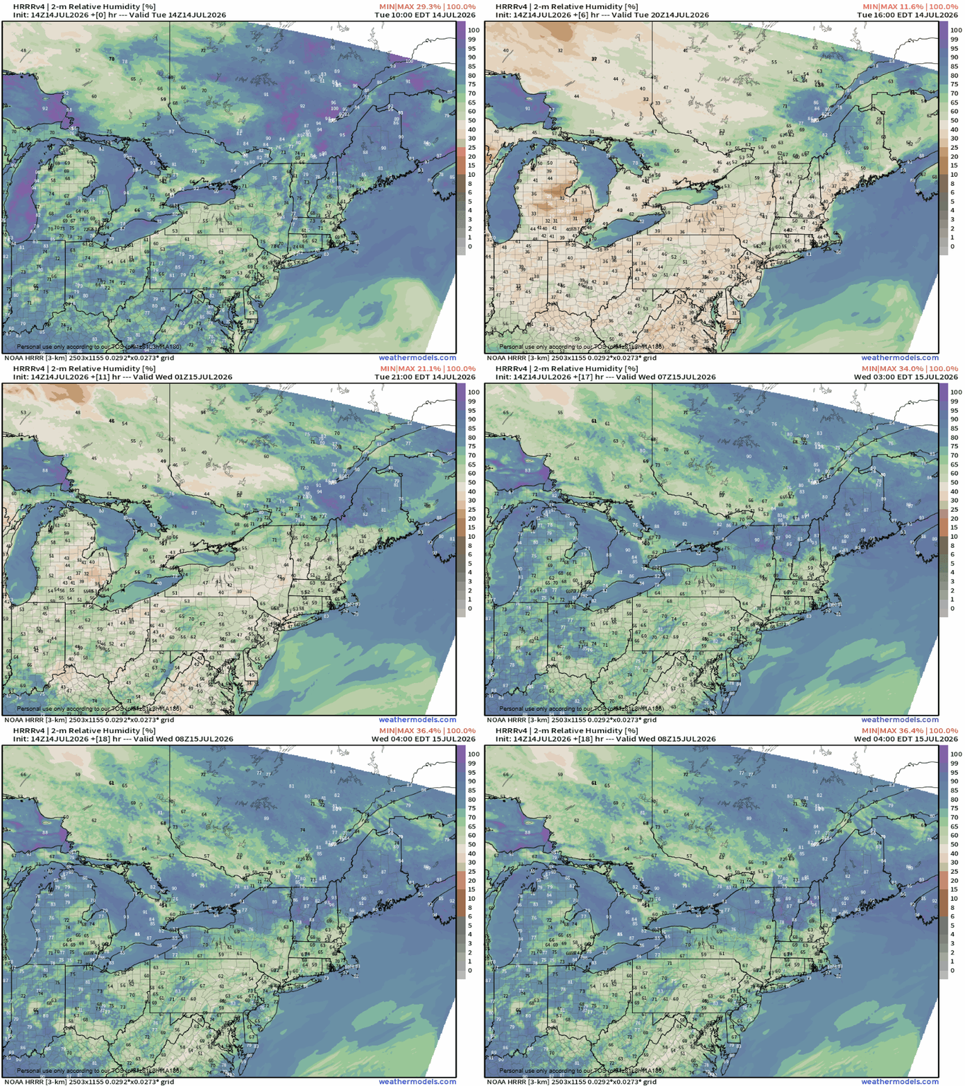
Weather from the northwest is generally hindered by a lack of humidity, as the further northward you move, the less available moisture there is. The less moisture, the less available total energy there is for storms to form, whereas weather from along the coast generally is limited by the ocean as systems leave New Jersey and pass over both the ocean and Long Island before impacting parts of New England.
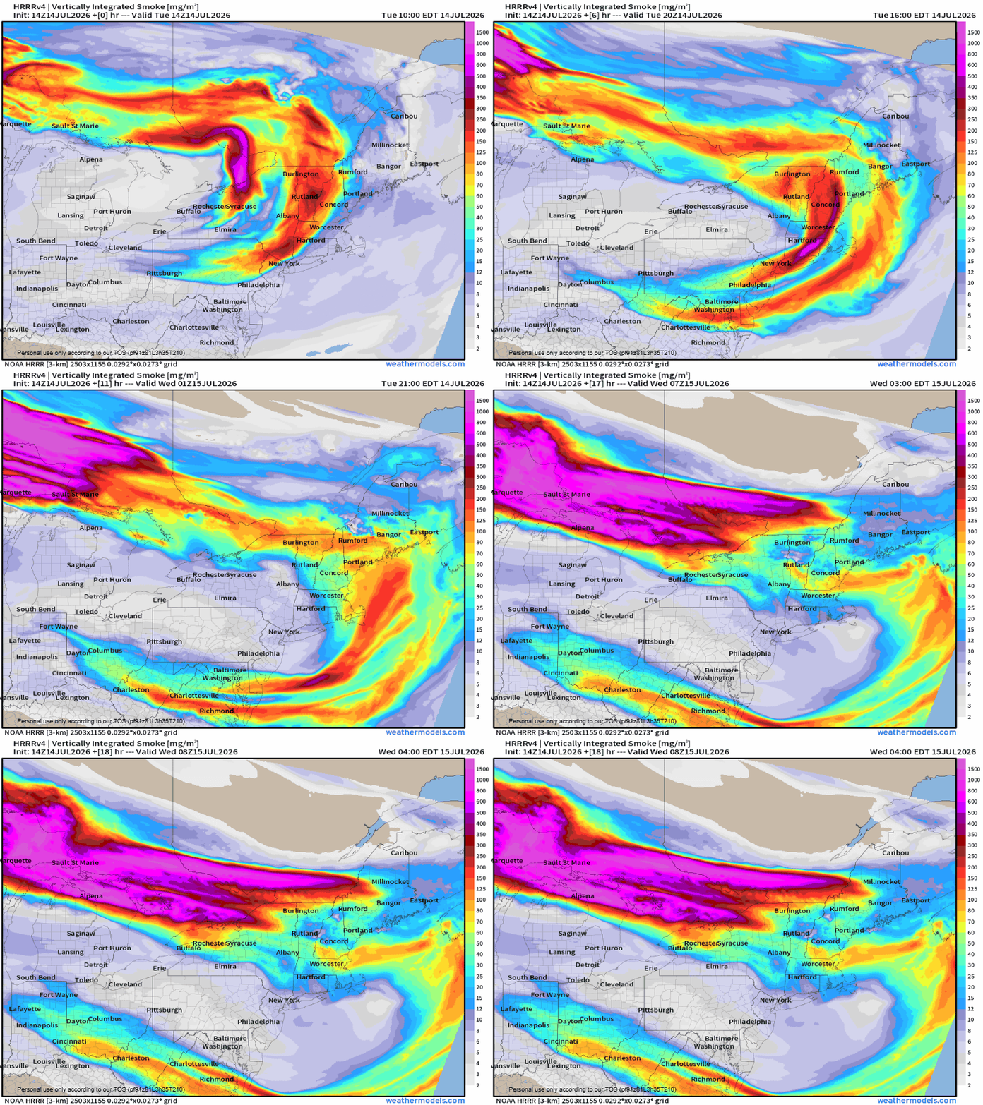
Wildfires also play a part in this, as the smoke from them gets high into the atmosphere, injecting drier air, but they can also promote storm formation if particulate that is released by them manages to mix with more moist air. Wildfires in Ontario are the source of the smoke for the next few days.
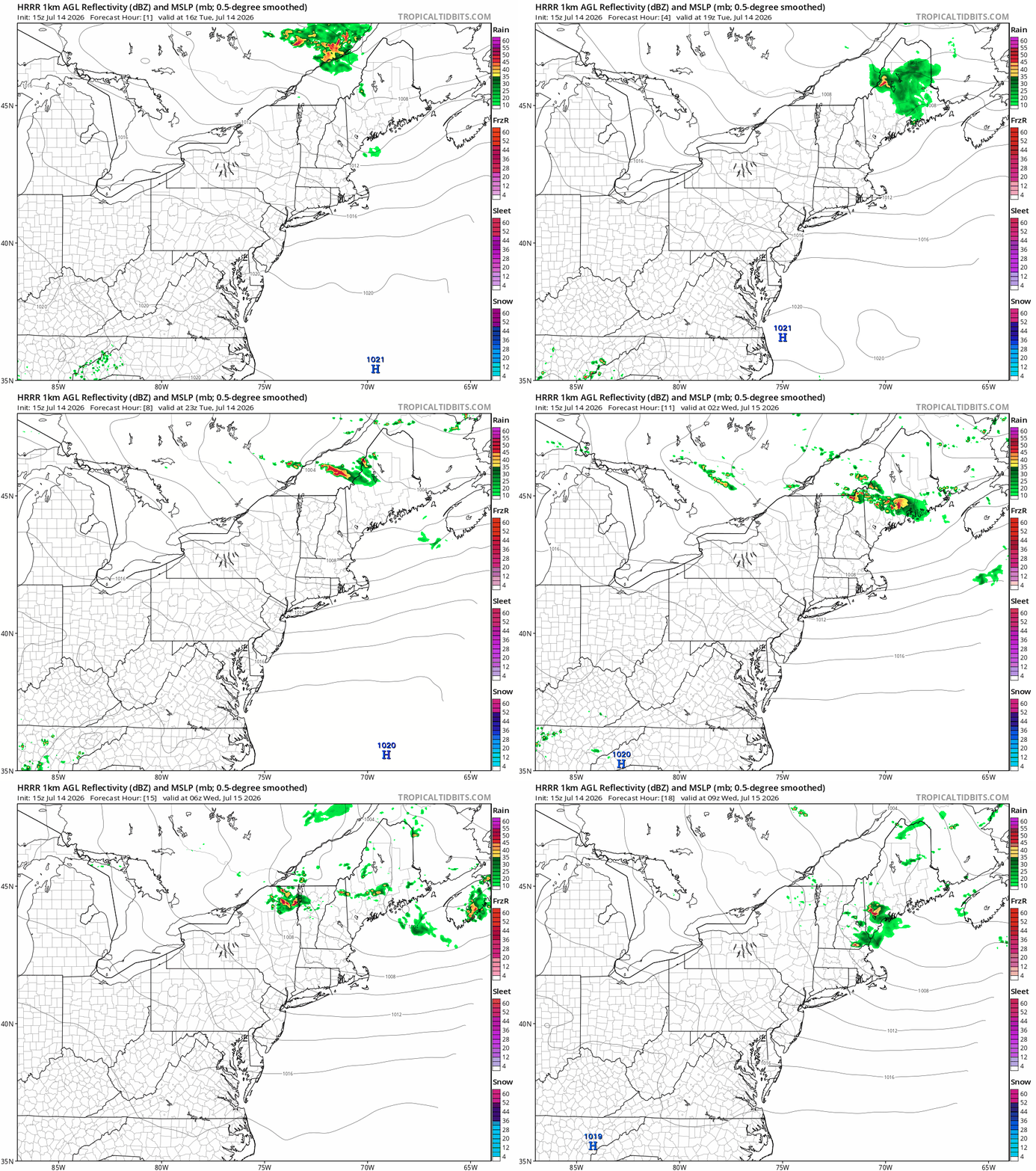
For the current storms moving through, wind, hail, and tornadoes are all expected to be on the stronger side when they occur. Most of the severe threat is limited to areas that are generally less populated in northern Vermont, New Hampshire and Maine, though this does not mean that severe weather won’t move into more populated regions, and a system could move through southern New Hampshire overnight on the 14th into the 15th, bringing showers and strong winds, with the potential for hail and tornadoes as the night progresses.
Cooler and drier air will move into New England on July 15 behind a cold front.