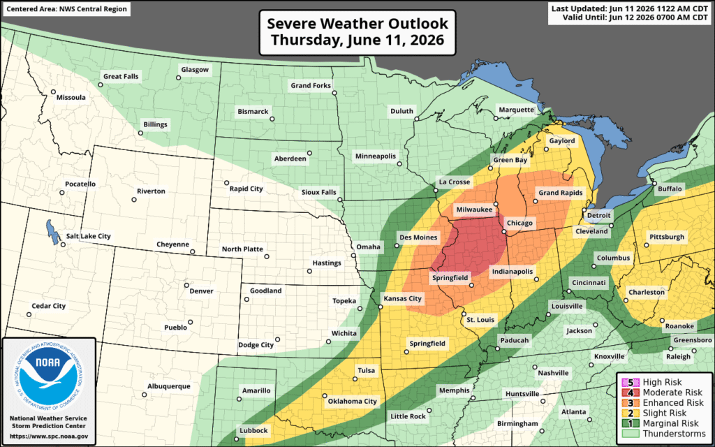
Severe Weather is continuing today and tonight in the Midwest, with a moderate risk of severe weather, up from yesterday’s enhanced risk. There is also an enhanced risk for both wind and tornadoes, with Northern Illinois and Southeastern Iowa under the greatest risk.
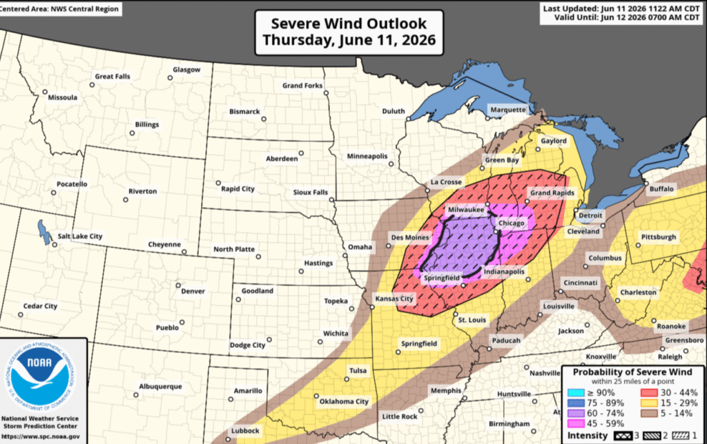
Starting in the Midwest, and the region of moderate severe weather, wind and tornadoes are the greatest threats. Northern Illinois is currently at the highest risk, with a 60-74% chance of destructive winds at any point within 25 miles of a location in that region. Northwest Indiana has a 45-59% risk within the same 25-mile range. The hatched region indicates elevated risk of 75 mph gusts, up from 50 mph in non-hatched areas, from downbursts or microbursts that can down trees or power lines, tear shingles off of roofs, and potentially destroy smaller and less structurally sound buildings.
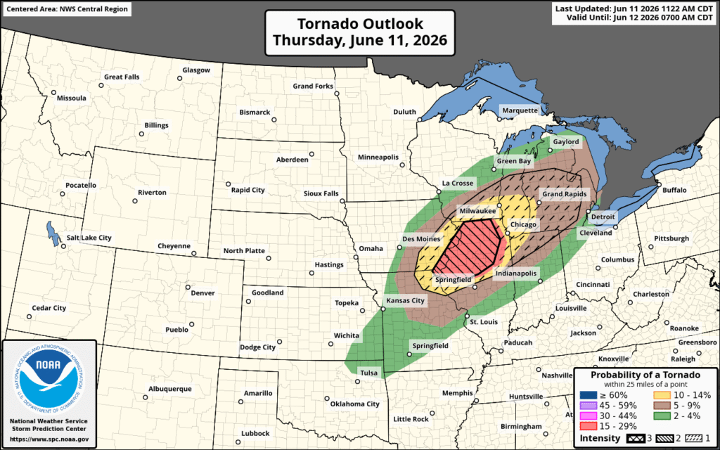
Northern Illinois has the highest risk of tornadoes, with a 15-29% chance of a tornado within 25 miles of any point in the dark red-shaded region. This region also has an elevated risk of a tornado being at least EF3, indicated by the left-leaning hatched region. Michigan, Missouri, Iowa, and Wisconsin have a 10-14% risk of a tornado, again within 25 miles of a point in the yellow shaded region. The dashed-hatched region indicates an elevated risk of a tornado being at least EF2 and extends across Michigan beyond the 10-14% risk. Tornadoes include all of the high-end wind threats and now also include potentially flipped vehicles or significant damage to well-built structures. Hail is also likely, with northern Illinois and northeastern Missouri potentially seeing 2-inch hail.
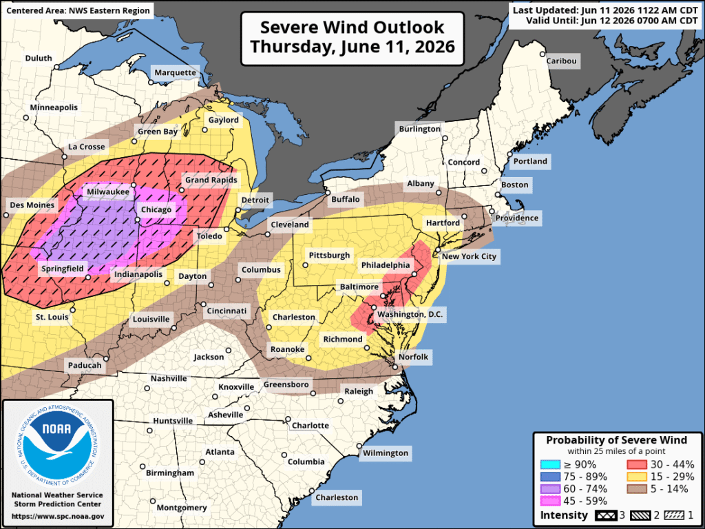
Moving over to the northeast, the greatest threats in this area tonight is wind and hail. Washington, D.C., Baltimore, and Philadelphia are at the highest risk, with a 30-44% chance of severe wind, while New York is just outside it in the 15-29% range. While coastal cities are used to strong sea breezes being amplified through narrow urban corridors, severe wind generally blows in a different direction than expected and is stronger than a simple sea breeze. Severe Hail is also expected, with a 5-14% chance of quarter-sized hail across the northeast.