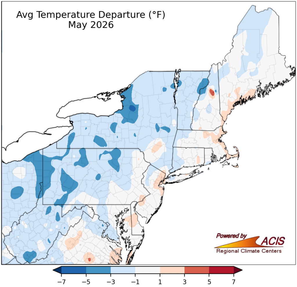
May 2026 was cooler than average for much of the Northeast, but the past week or two have seen warmer temperatures, though that might change this weekend.
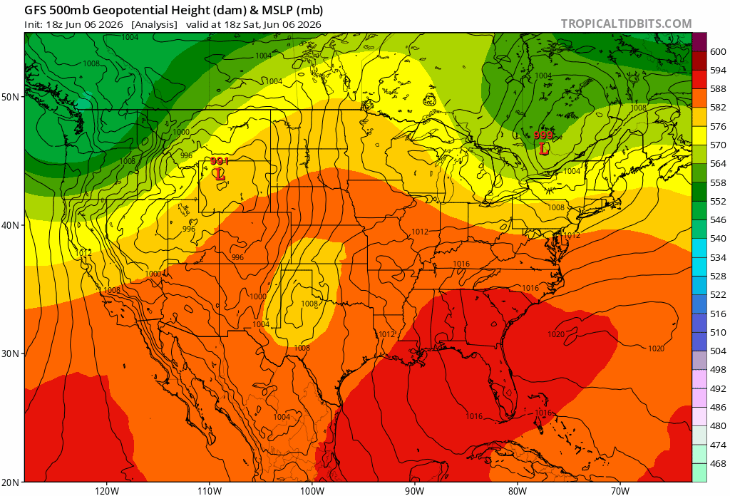
A back door cold front is moving through the northeast, bringing short relief from the heat, but a ridge of high pressure in the north central US is giving way to severe weather expected to move across the northern US. Temperatures in the 80s and 90s are expected until the weekend, as a large area of low pressure follows the severe weather, bringing highs in the 60s to 70s for the East, and potentially into the 50s in the Central US.
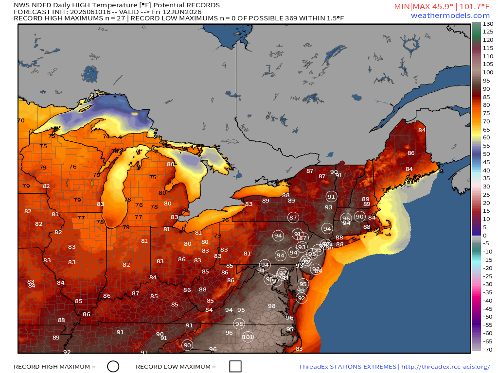
The warmest weather is expected on Thursday and Friday, as the high pressure sets up offshore, bringing warm humid air up the coast. Records could be set once again along the I-95 corridor, with temperatures well into the 90s, potentially reaching triple digits in North Carolina. Water temperatures along the coast have warmed up, with temperatures in the 50s and 60s along New England and into the 80s along the Southeast and Gulf Coast, providing some relief for people heading to the beaches. Cool temperatures should return over the weekend as a cold front moves through the region.
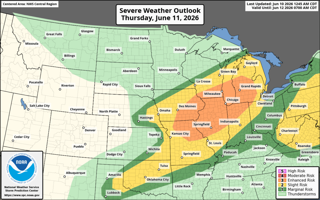
While the Eastern US can expect severe weather on Thursday and Friday, most of the Midwest is looking at severe weather continuing into Thursday.
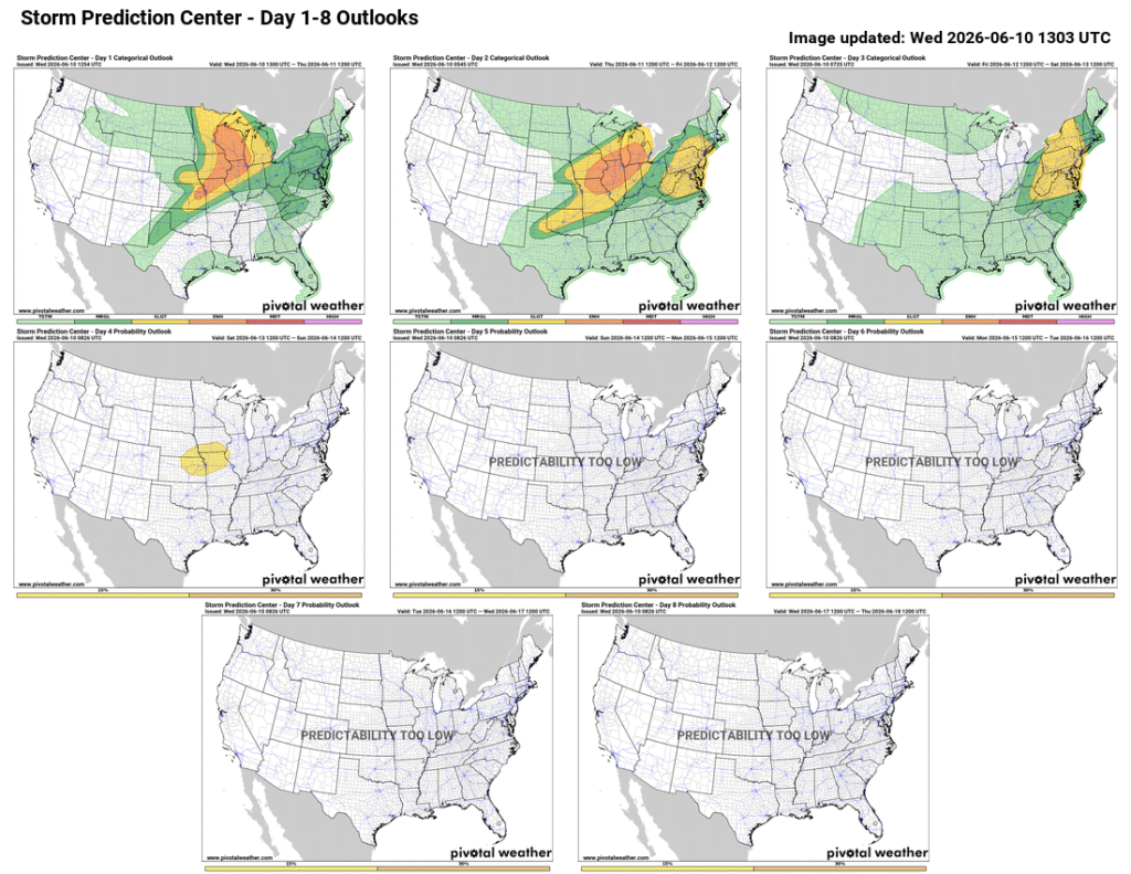
A low pressure trough pushing through a high pressure ridge promoted development of severe weather Tuesday night, which is expected to continue into Wednesday night and Thursday. Strong to severe thunderstorms are likely from the Central Plains northeastward into the Great Lakes, with an area developing along the East Coast on Thursday. Today, much of the Midwest can expect severe weather to continue, bringing strong winds, hail, and potentially tornadoes to the region, with a stronger wind threat Thursday, alongside continued hail and tornado risks.
As the system moves through, high pressure builds in behind it, bringing cooler temperatures and calmer weather. The East Coast can expect cooler weather on the weekend as the high makes its way to the region.