The 2025 Hurricane Season has been fairly quiet across both the Atlantic and Pacific, especially over the past month, but that has quickly changed in the past week.
Hurricane Gabrielle remains a powerful Category 3 hurricane this evening in the central Atlantic. As of 11pm EDT Gabrielle was centered about 1520 miles west of the Azores, moving toward the east-northeast at 22 mph. After peaking as a Category 4 storm while passing east of Bermuda on Monday, maximum sustained winds have decreased to near 125 mph. Gabrielle is expected to head eastward over the open waters of the Atlantic at a rapid pace over the next few days while steadily weakening as it crosses cooler water. The system is still expected to be a minimal hurricane when it crosses the Azores late Thursday into Friday. As a result, a Hurricane Watch has been issued for the island chain. After that, it should become extratropical as it approaches the coast of Portugal this weekend. Gabrielle will continue to produce rough surf across the East Coast, with a high risk for rip currents across much of the region.
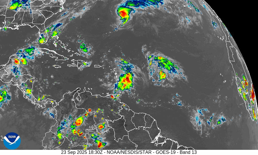
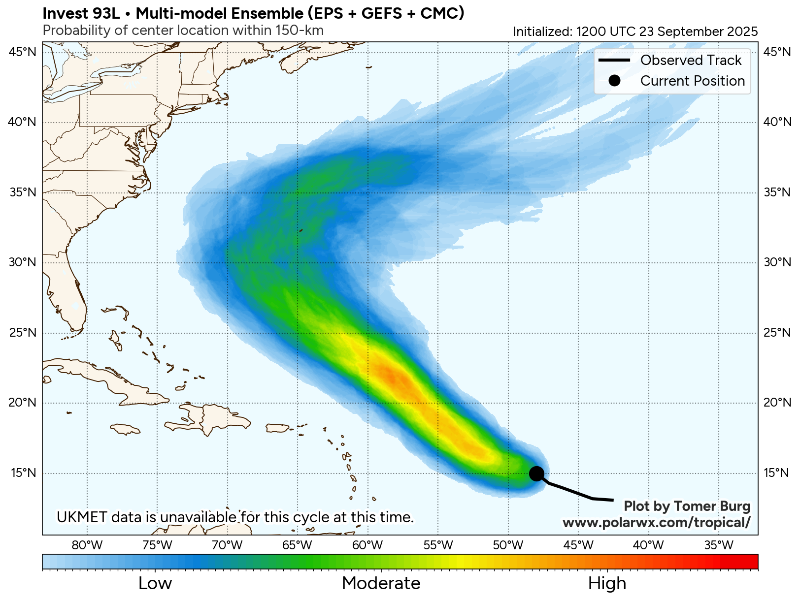
Gabrielle isn’t the only system we’re keeping an eye on in the Atlantic. There are two tropical waves, one about 750 miles east of the Leeward Islands, and the other crossing the northeastern Caribbean, that are both slowly organizing.
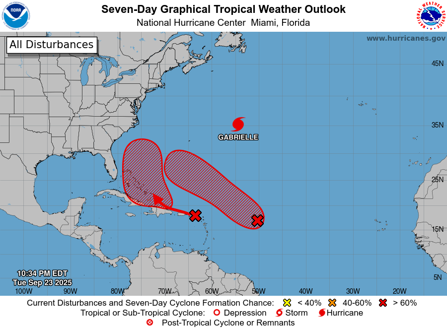
The westernmost wave will bring squally conditions to the northeastern Caribbean, including Puerto Rico and the Virgin Islands for the next day or two. After that, it should move towards the Turks and Caicos, Dominican Republic, and the Bahamas, where conditions will be more favorable for the system to develop. How quickly it develops and where it heads are still uncertain, but interests in the Bahamas and along the East Coast should keep a close eye on this system and its development later this week.
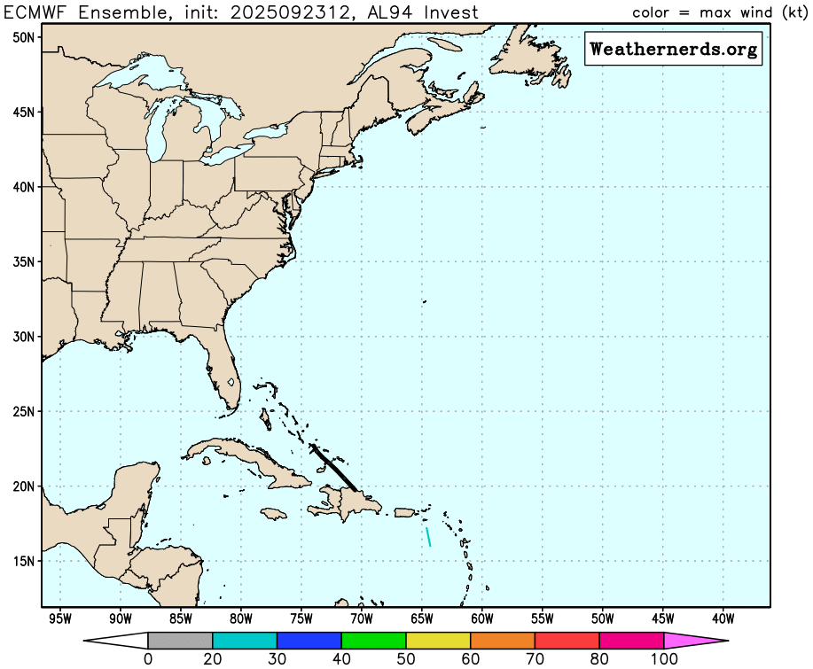
The system farther to the east is a bit more organized at this time, and has a better chance to become a tropical depression later this week. Forecast models show this system heading more toward the northwest, likely staying north of the Lesser Antilles, while steadily strengthening. This system could follow a track similar to what Gabrielle did last weekend, and could become a threat to Bermuda towards the end of the week.
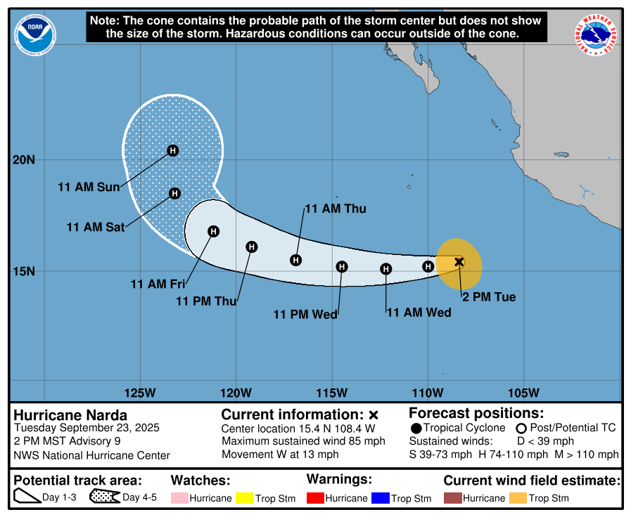
In the Eastern Pacific, Hurricane Narda continues to strengthen as it heads away from the coast of Mexico. As of 5pm EDT, Narda had maximum sustained winds near 85 mph while centered about 365 miles southwest of Manzanillo, Mexico, moving toward the west at 13 mph. The forecast for Narda is fairly straightforward for the next few days. It should continue westward over open water in the Eastern Pacific while strengthening, likely reaching Category 2 strength, possibly a a weak Category 3. Towards the end of the week it will turn more toward the northwest and then north, steadily weakening as it moves over cooler water.
Over in the Western Pacific, Typhoon Ragasa is passing about 200 miles south of Hong Kong, on its way to landfall in southern China on Wednesday. It still has top winds near 125 mph, but it expected to weaken a bit more before landfall. Over the weekend at peaked as a Super Typhoon with sustained winds near 170 mph as it passes just north of Luzon in the Philippines.
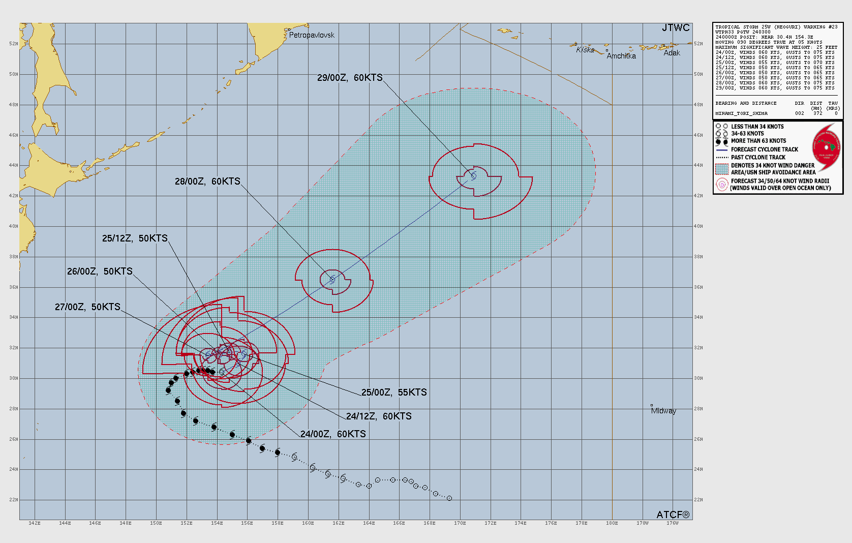
Typhoon Neoguri is centered about 1000 miles east-southeast of Japan this evening. Maximum sustained winds had decreased to near 75 mph. Neoguri is expected to mill around for the next couple of days while slowly weakening, not threatening any land areas. By the end of the week it should start to head northeastward, likely becoming a potent extratropical system as it heads toward the Gulf of Alaska.
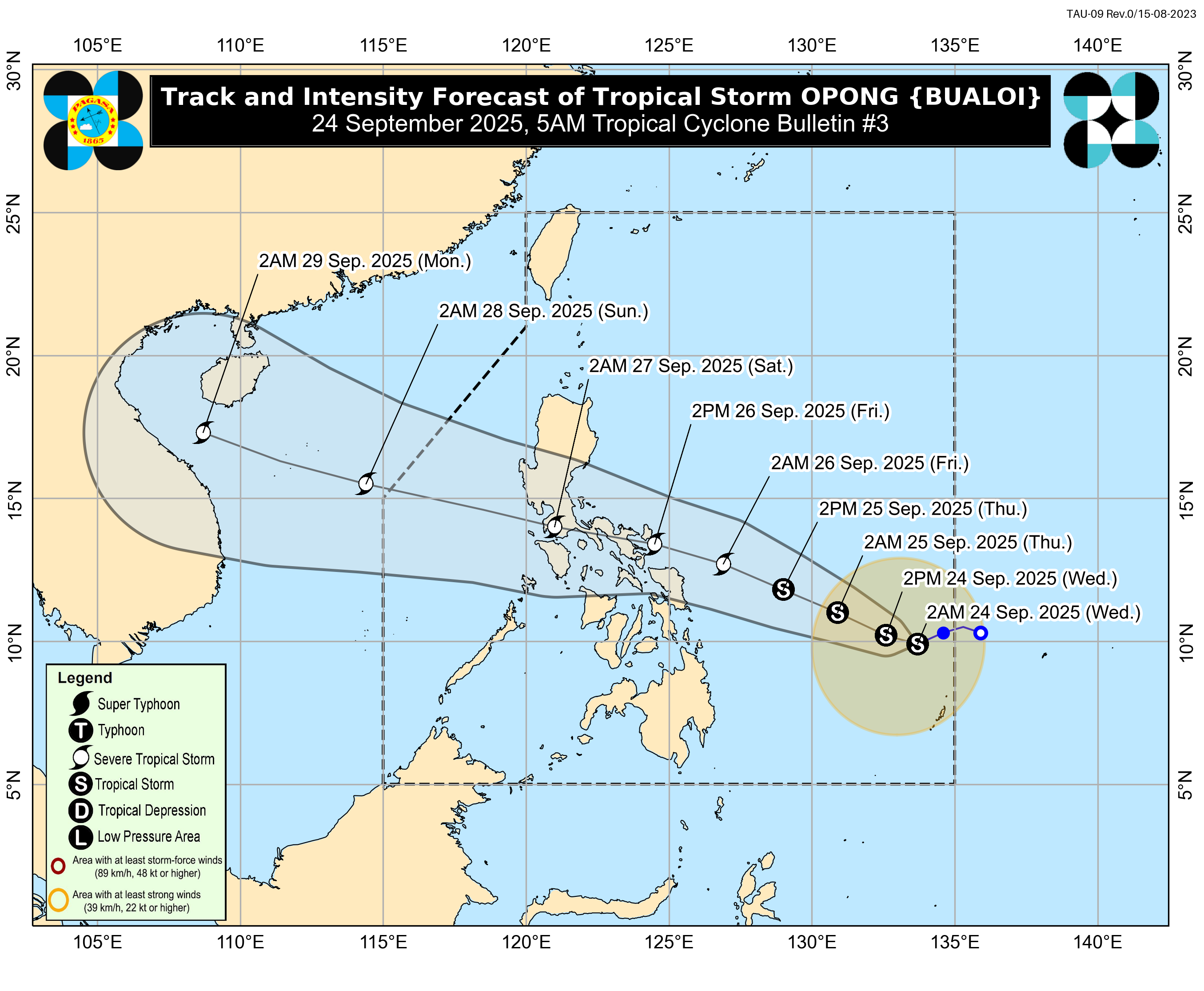
Tropical Storm Bualoi has developed well east of the Philippines this evening. The system currently has maximum sustained winds near 40 mph, and should steadily strengthen over the next few days while heading off toward the west-northwest. Current forecasts are for the system to be near typhoon strength as it crosses the central Philippines at the end of the week and start of the weekend. After that, it should move into the South China Sea and could become a threat to Vietnam by early next week.
Although the peak of hurricane season is in mid-September, the rest of September and much of October is usually active across most of the Northern Hemisphere, so this active period could continue beyond the next week or so.