September is normally the peak of hurricane season, but that hasn’t been that case this year, things have been quiet for a while now, though that could be changing.
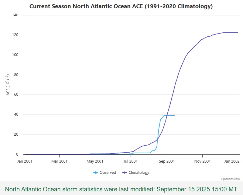
The last time there was an active system in the Atlantic was on August 29, when Tropical Storm Fernand became extratropical more than 600 miles east-southeast of Newfoundland, in the open waters of the North Atlantic. Climatologically, the peak of the season is September 10 – the day you are most likely to observe a tropical cyclone somewhere in the Atlantic, Caribbean, or the Gulf. Instead, we’re at 18 days and counting without a system. How unusual is that? The last time there were no active systems in the Atlantic between August 29 and September 15 was in 1939, right at the start of World War II. However, that quiet period may be coming to an end over the next few days.
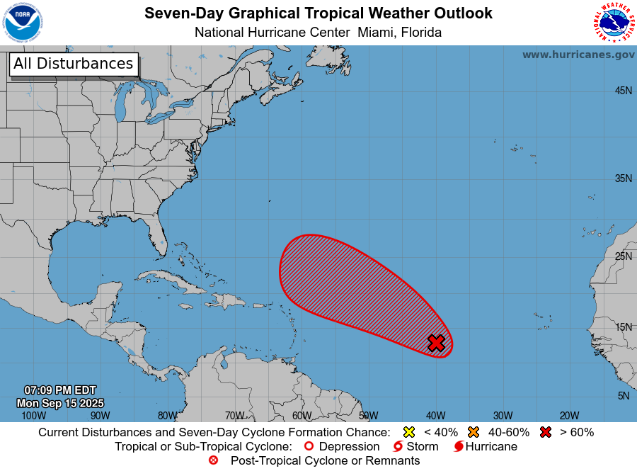
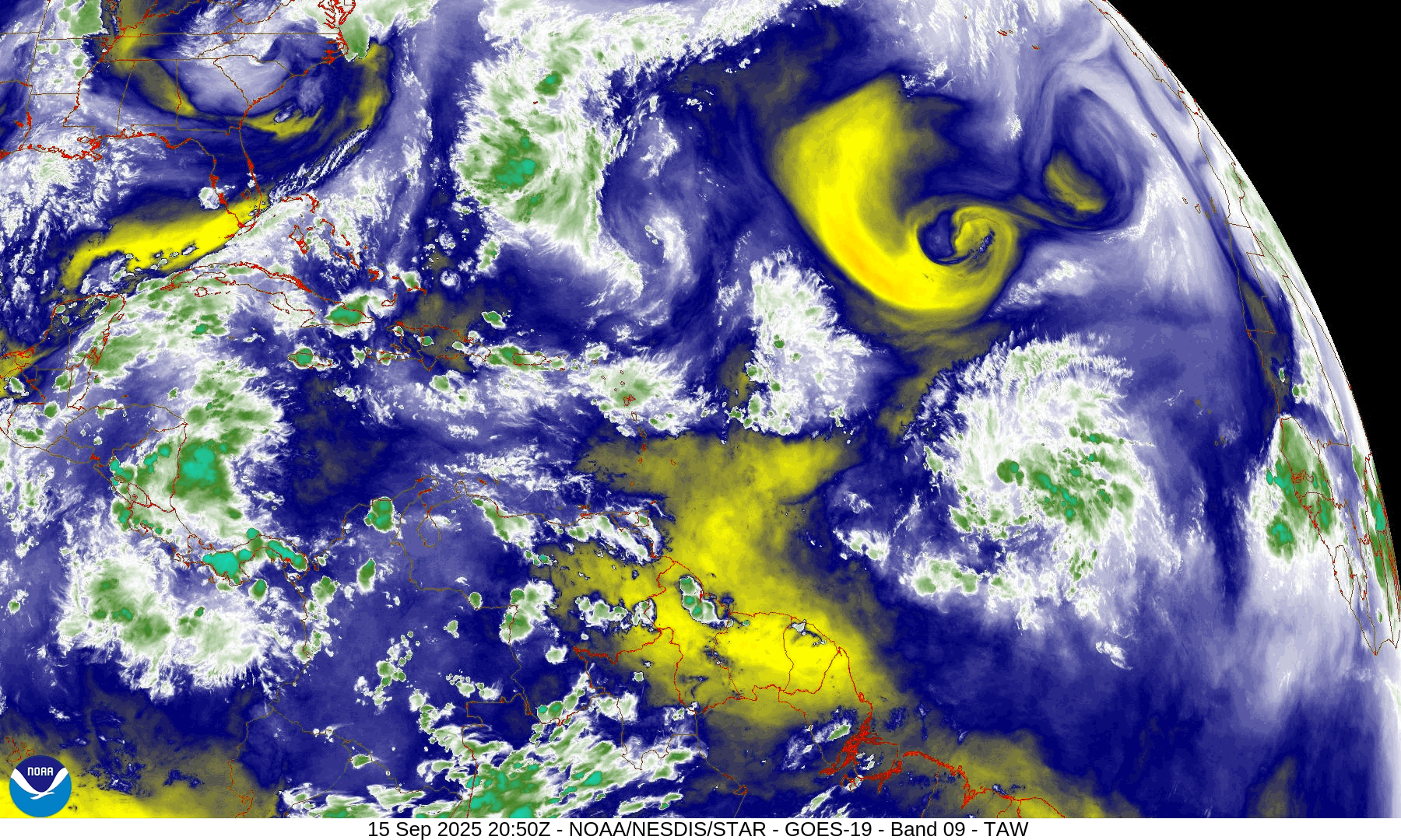
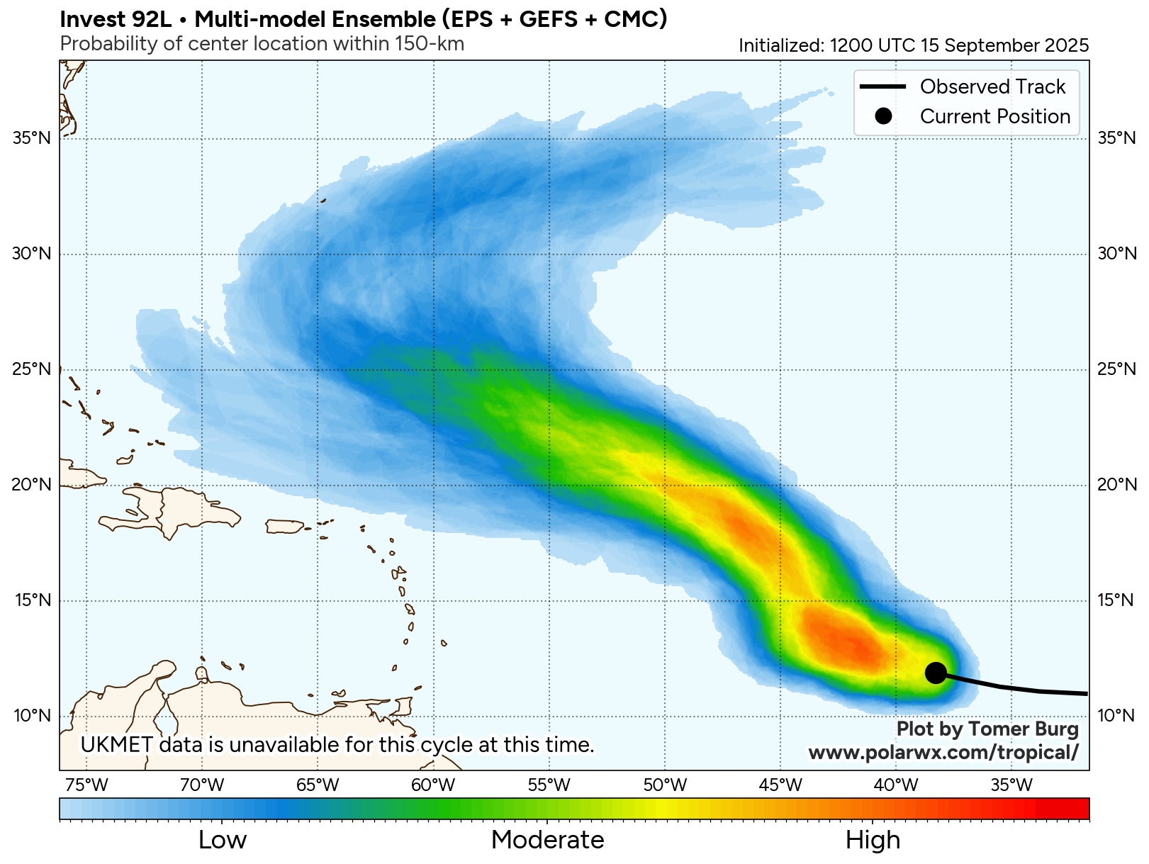
A tropical wave that is making its way across the Atlantic’s Main Development Region is slowly getting its act together. Shower and thunderstorm activity is disorganized at this time, and upper-level conditions are not that favorable right now, but as the system continues west to west-northwestward over the next few days, some additional development is likely. There is some dry air ahead of the system, but as it starts to gain latitude, it should encounter a more moist environment. Additionally, there is an upper-level low pressure area to the north of the system, but as it heads westward, it should pull away from that, encountering more favorable conditions for development. Sea Surface Temperatures are already warm enough, so that shouldn’t be an inhibiting factor.
Most of the forecast models are showing the potential for the system to organize into a tropical depression during the middle to latter portion of the week as it continues to head west-northwestward. Additional strengthening is expected, and the system could become Tropical Storm Gabrielle by this coming weekend. As for where it should go, with a ridge of high pressure over the central Atlantic, it should continue west-northwestward through much of the week. By the weekend, it could reach the western edge of that ridge and turn more toward the north and the eventually northeast and out to sea. Where it makes that turn will determine whether the system will eventually be a threat to Bermuda, but otherwise, it does not look like this system will be a threat to any other land areas over the next 5-7 days.
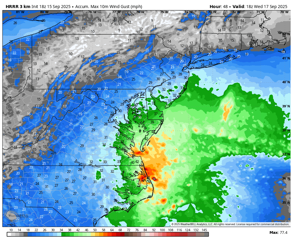
Closer to the United States, there’s another system we’re keeping an eye on, though it isn’t tropical at this time. Low pressure has developed along an old frontal boundary off the North Carolina coastline. Meanwhile, there’s an upper-level low pressure area over central North Carolina. That upper-level low will pull the surface storm towards the coast of eastern North Carolina and the Virginia Tidewater into Tuesday. This will result in some heavy rain along with embedded thunderstorms across the region over the next day or two. Locations from Richmond to Raleigh and points eastward could receive 2-4 inches of rain by Wednesday morning, with isolated totals in excess of 5 inches possible.
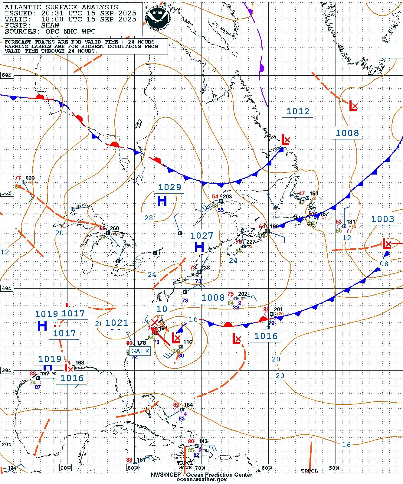
With a large area of high pressure to the north, the system won’t move that much for the next 24 hours, but should start to pull away and head out to sea by Wednesday and Thursday. The gradient between the high to the north and the low pressure area will result in some rather gusty winds, especially near the coast. Wind gusts of 35-45 mph and perhaps stronger are expected for coastal areas from Southern New Jersey to the North Carolina Outer Banks through Wednesday. In addition to the hazardous marine conditions, this will create a high risk for dangerous rip currents at beaches in this stretch. That high pressure area will also block any northward progress the storm will try to make, preventing much-needed significant rainfall from reaching portions of New England and southeastern New York, where a significant drought has been worsening over the past few months.