As we begin the Independence Day holiday weekend, high pressure will bring dry weather to many areas of the eastern United States, while places out West could see unsettled weather. A frontal system will move east into the start of next week, bringing showers and thunderstorms across the northern and eastern half of the country. Hot and potentially dangerous temperatures are possible into the start of the week across the Midwest and Northeast. Eyes are on the waters off the Southeast, where tropical storm development is possible around mid-week.
Friday – Independence Day
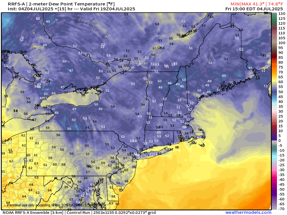
A cold front that has recently crossed the Northeast will provide perfect weather for the region, high pressure bringing sunshine and lower dewpoints, keeping humidity at a very comfortable level. High pressure will continue to dominate from the Great Lakes to the Gulf Coast, bringing sunshine to most of the Eastern United States.
Other areas of the Southeast will see the potential for rain as a low pressure near Florida allows the rain to continue. Remnants of the very short-lived Tropical Storm Barry will also bring the chance for rain and thunderstorms to most of Texas.
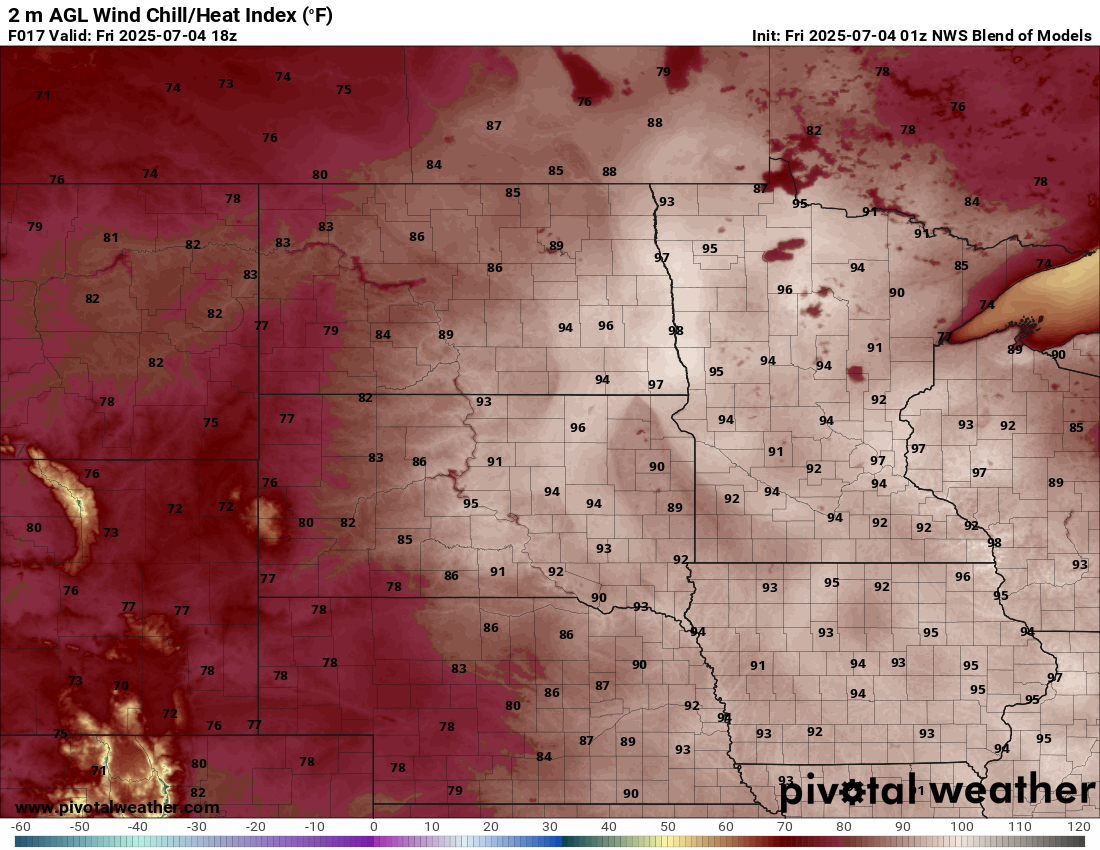
Hot and potentially dangerous temperatures are possible across the Upper Mississippi Valley and Northern Plains ahead of a cold front extending from a low pressure system in central Canada. This frontal system will bring rain and thunderstorms to the region, with a marginal risk of strong to severe thunderstorms.
Monsoonal moisture will produce showers and thunderstorms across parts of the Southwest, especially during the afternoon. A system in the Northwestern United States will bring showers with a chance of thunderstorms to the Pacific Northwest, Great Basin, and Intermountain West.
Saturday
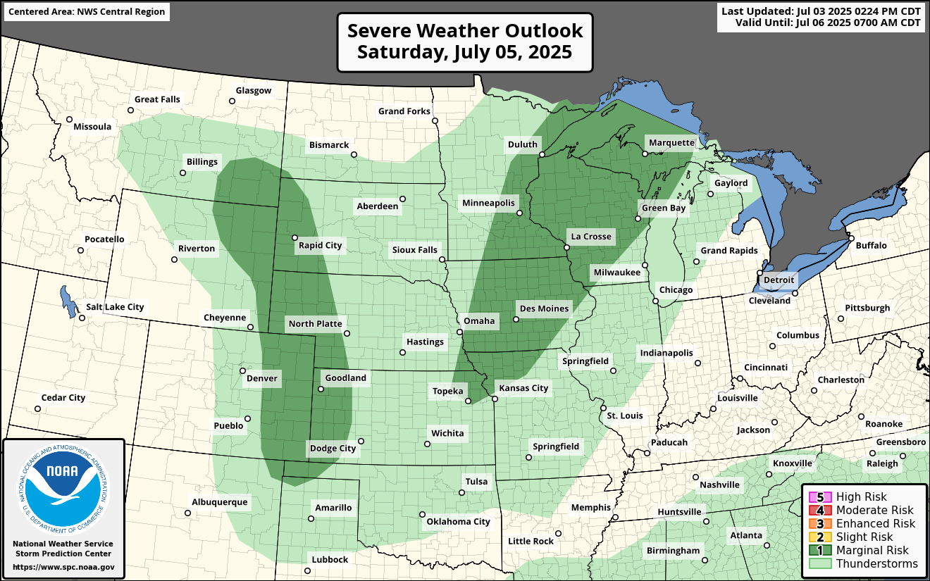
The hot temperatures will progress east as the frontal system moves across the northern United States, the marginal risk of severe weather continues across the Upper Great Lakes while also shifting to the central Mississippi Valley. The front will wrap up into the Central Plains as it converges with a weaker system in the Northwest, with a marginal risk of severe weather in the west-central Plains.
The low pressure near Florida will bring another day of showers and thunderstorms to the state as moisture from Barry continues to sit over Texas, with more showers and thunderstorms possible.
Monsoonal moisture will allow the potential for afternoon showers and thunderstorms to return across the Southwest.
Sunday
Showers and thunderstorms will begin to taper off across Florida as the low pressure system nearby slowly pulls away from the region and moves up the East Coast, bringing shower and thunderstorm activity into the Mid-Atlantic.
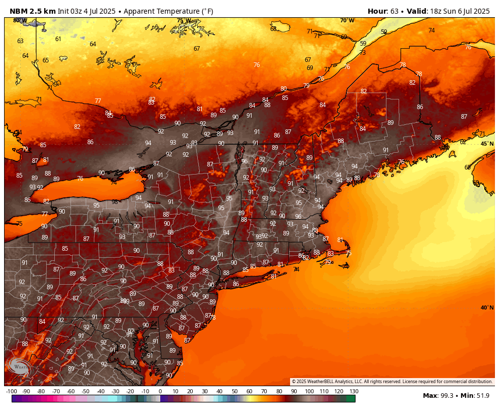
Hot and humid weather will return to the Northeast as the frontal system continues its eastward progression. Showers and thunderstorms are possible from the Great Lakes to the Southern Plains. The weaker system follows behind the main system, bringing the potential for showers and thunderstorms to the Central and Northern Plains.
Monsoonal moisture could potentially bring more showers and thunderstorms to the Southwest.
Monday through Friday
Hot and humid weather will continue across the Northeast on Monday as the frontal system continues its progression east with showers and thunderstorms possible from the Northeast to the Southern Plains. A weaker low pressure system following this system will continue to produce showers and thunderstorms through the Central Plains.
The low pressure system in the Southeast will continue its journey up the East Coast, allowing for the potential of showers and thunderstorms across the Mid-Atlantic. This system will begin to interact with the large frontal system on Tuesday, allowing the front to become stationary across the Tennessee Valley. The stationary front will produce showers and thunderstorms from the Ohio Valley to the Gulf Coast through the end of the week. These two systems will be monitored for tropical system development as they move offshore.
The smaller low pressure in the Central Plains will begin to weaken on Tuesday, allowing the shower and thunderstorm potential to diminish. Drier weather is expected through the middle of the week before another system develops toward the end of the week, bringing the potential for showers and thunderstorms.
Monsoon moisture will allow for the potential of afternoon showers and thunderstorms each afternoon.