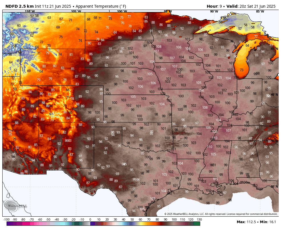
Hot and humid conditions are expected across the eastern half of the nation as we go through the first weekend of summer.
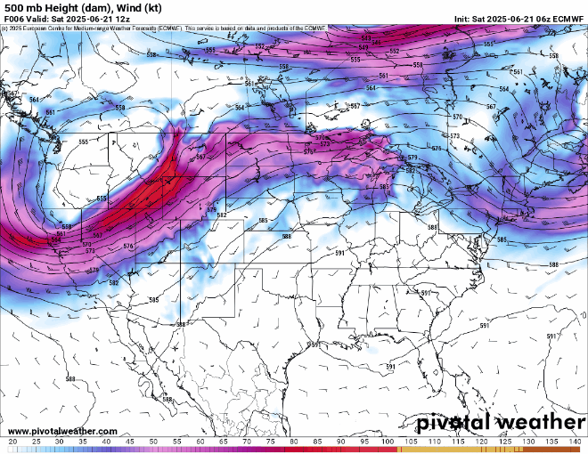
A large ridge of high pressure centered over the Mississippi and Tennessee Valleys Saturday morning will slowly move eastward over the next few days, resulting in hot and humid conditions for a large portion of the nation. The heat and humidity are focused on the Plains States and Mississippi Valley to start the weekend with Heat Advisories and Extreme Heat Warnings in place from the Northern and Central Plains into the Mississippi Valley and the Midwest. High temperatures will reach the 90s in much of this region, with highs topping 100 in parts of the Northern and Central Plains, possibly setting records in a few spots. With dewpoints in the upper 60s and 70s, the heat index will reach 100 to as high as 110 in much of the region. The heat will continue into Sunday, with widespread highs in the 90s and lower 100s expected once again and heat indices in excess of 100, but an approaching cold front will produce showers and thunderstorms during the afternoon and evening, some of which could be strong to severe, bringing relief to the region.
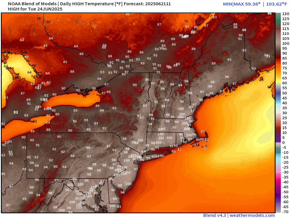
The heat and humidity will shift into the Great Lakes and Northeast on Sunday, with record highs expected in many areas as temperatures rise well into the 90s. Dewpoints will be climbing into the 60s and 70s, resulting in heat indices near or over 100. Heat Advisories and Extreme Heat Watches and Warnings have been issued for much of this region. As we head into the start of the new week, the focus of the heat will shift once again to the heavily-populated Interstate 95 corridor along the East Coast. High temperatures in the upper 90s to possibly lower 100s are expected on Monday in this area likely setting records in dozens of locations, more likely on Tuesday. When the humidity is factored in, the heat index will reach 105 to 110 degrees in many areas. Little relief is expected at night, as nighttime lows only drop into the 70s, with some of the urban areas possibly staying above 80. A backdoor cold front may bring some relief to parts of New England, possibly as far south as the New York City area on Wednesday, but heat and humidity will continue across the Mid-Atlantic states.
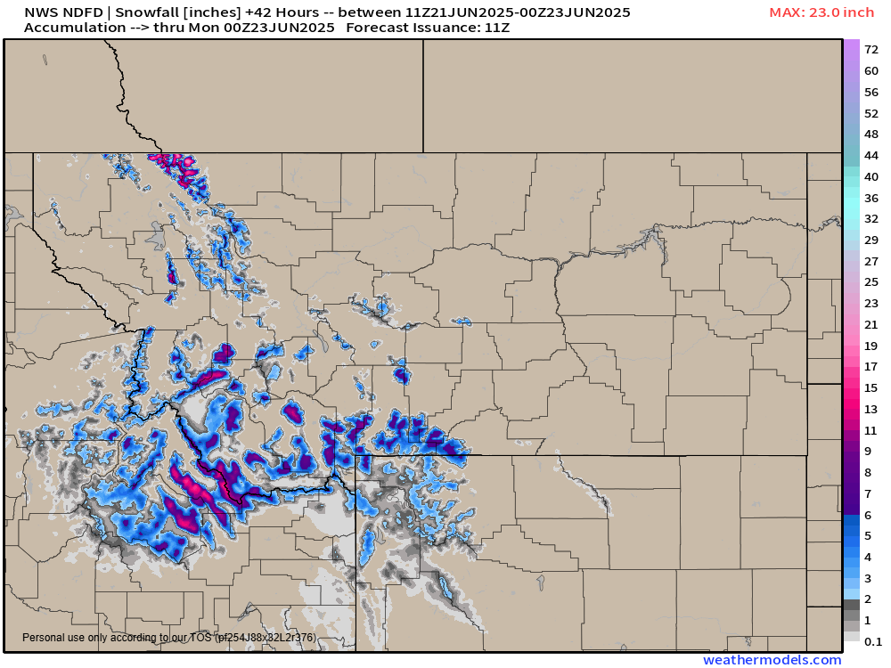
While heat is making headlines across the eastern half of the nation, in the Northern Rockies, a late-season winter storm is moving in. A storm system moving in will bring strong winds and heavy precipitation to the region today and into Sunday. Sustained winds of 30-40 mph with gusts in excess of 60 mph are expected in some areas. Across the higher elevations of western Montana and eastern Idaho snow levels have fallen as low as 5000 feet. Above that level, snowfall totals of 4-8 inches are expected by Sunday morning, with totals of 10-20 inches expected once you get above 6000 feet. Winter Storm Warnings and Winter Weather Advisories have been issued for much of this region. The chilly weather won’t last long, as temperatures return to near to above normal levels across the region by Tuesday.