As we get into the end of August, we are moving into the peak of hurricane season. As expected, the tropics have awakened, with plenty of activity to watch, but thus far, much of it remains disorganized.
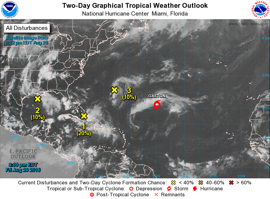
Starting in the Atlantic, we have Tropical Storm Gaston. Gaston was centered about 900 miles east-southeast of Bermuda Friday evening, moving towards the northwest at 15 mph. While Gaston was briefly upgraded to a hurricane earlier in the week, it currently has maximum sustained winds of 65 mph. Conditions are favorable for Gaston to strengthen this weekend and become a hurricane once again. The storm should turn more toward the north and eventually northeast, remaining over open waters into the start of the upcoming week.
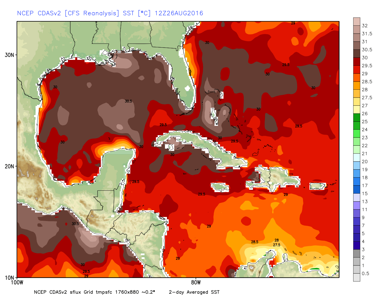
A disorganized area of showers and thunderstorms is moving across the Central Bahamas this evening. For several days, many of the forecast models have been showing the potential for this storm to develop and possibly impact Florida and/or the Gulf Coast. Despite this, the system has not developed, and conditions will be unfavorable into the weekend for any further development. Several models are still showing the potential for the system to develop once it gets into the Gulf of Mexico. Water temperatures are very warm across the Gulf, which would help to fuel any developing system. Anyone with interests in and around the Gulf Coast should keep an eye on the progress of this system.
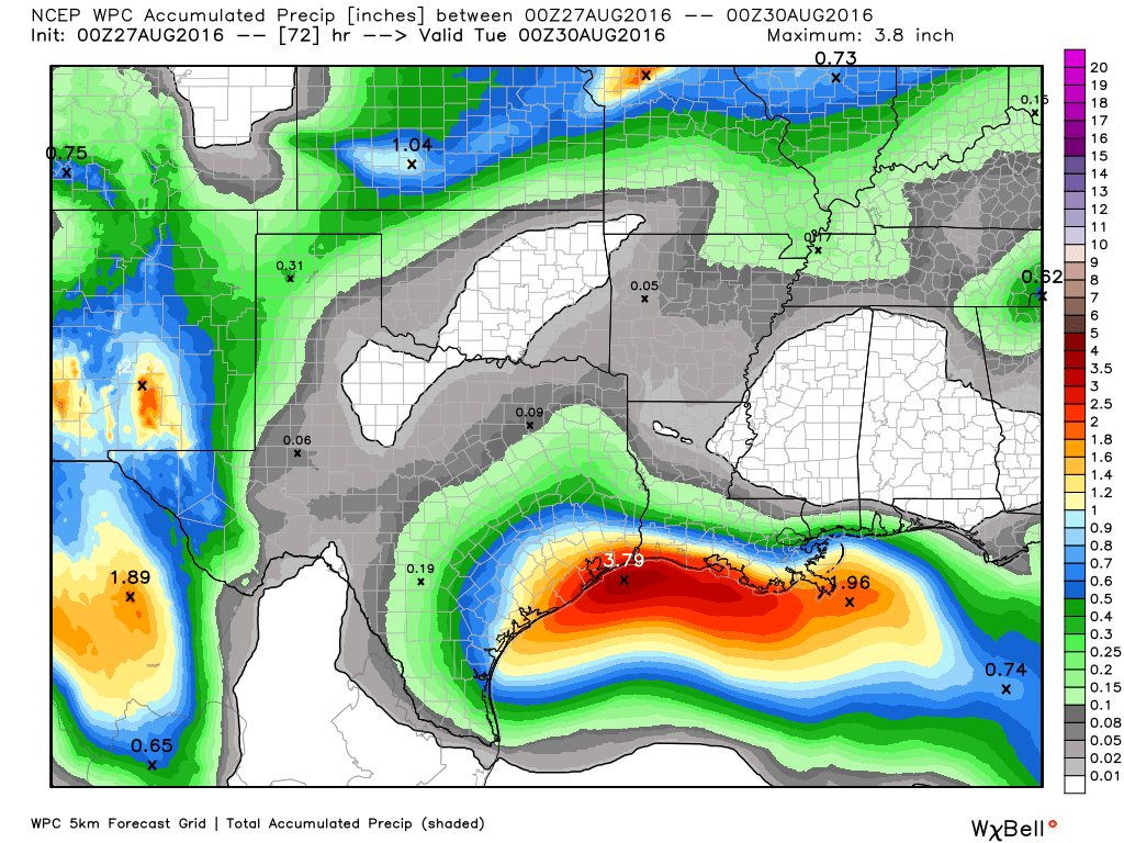
Meanwhile, there is a weak trough of low-pressure already located in the northern Gulf of Mexico this is being watched. Upper-level conditions are not favorable for development of this system, but it will bring heavy rainfall to portions of Louisiana and Texas this weekend. This is not good news for areas that were hit hard by flooding just a few weeks ago.
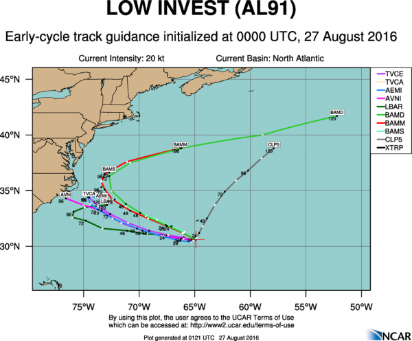
Another disturbance has developed just south of Bermuda this evening. This system is expected to remain weak for the next few days while moving very little. Eventually it should start drifting westward, and some slow development is possible. This system may bring some showers and thunderstorms to Bermuda this weekend and parts of eastern North Carolina during the early part of the upcoming week, but otherwise should not have much of an impact on any land areas.
While the Atlantic is filled with potential tropical systems, the Pacific has a couple of named systems, one of which could be a threat to land.
Hurricane Lester was centered about 550 miles southwest of Cabo San Lucas, Mexico Friday evening. Lester has maximum sustained winds near 75 mph, and additional strengthening is expected. Lester is currently moving toward the west at 9 mph, and a general westerly track is expected to continue through the weekend. Lester is not a threat to land for the next several days, however, some models are showing that it could have some impacts of Hawaii towards next weekend.
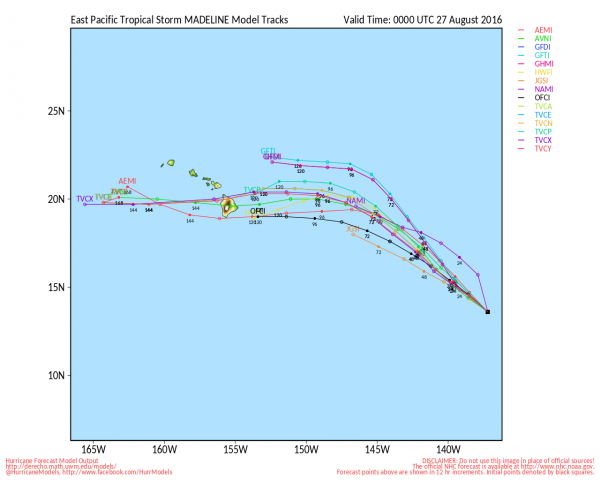
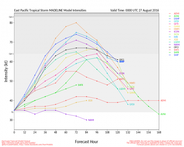
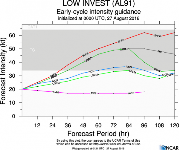
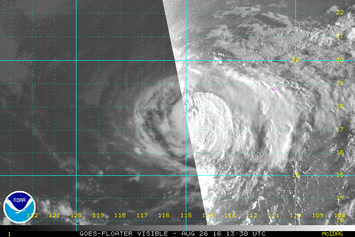
Tropical Storm Madeline could be a more immediate threat to Hawaii. Tropical Depression 14-E developed earlier on Friday about 1250 miles east-southeast of Hilo, Hawaii, and was upgraded to Tropical Storm Madeline Friday evening. Madeline has maximum sustained winds near 40 mph, and additional strengthening is expected. Madeline could become a hurricane by the end of the weekend or beginning of next week. The storm is expected to track towards the northwest this weekend before turning more towards the west. On this track, Madeline could approach the Hawaiian Islands towards midweek. Residents of the region should keep an eye on Madeline’s progress during the next few days.
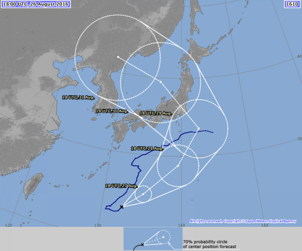
In the Western Pacific, Typhoon Lionrock has been slowly meandering around south of Japan for much of the past week, but that looks like it is about to change. As of Friday evening, the storm has maximum sustained winds near 110 mph, and some additional strengthening is possible this weekend. A track toward the northeast is expected this weekend, but a turn more toward the north and eventually northwest is likely by Sunday or Monday. On this track, the typhoon would make landfall in southeastern or eastern Japan on Monday.