After a relatively warm summer and early autumn, some of the coldest air so far this season will sweep southward from Canada over the next several days.
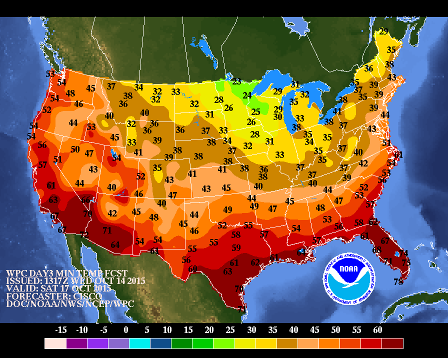
A cold front will drop southward across the Plains and the Great Lakes on Thursday with a large high pressure area building in southward behind it. Scattered showers are expected ahead of the front, but they will be mainly light. The bigger story will be gusty northwest winds behind the front ushering the cooler air into the region. Frost Advisories and Freeze Watches have already been posted for Friday morning across portions of Nebraska, Kansas, and eastern Colorado, and more will likely be issued.
As the front marches eastward Thursday night and Friday showers will spread into the Northeast while the cold air pours into the Midwest. Rain could mix with some wet snow before ending across portions of northern Minnesota and the Upper Peninsula of Michigan. As high pressure builds in, skies will clear out across parts of the area and winds will diminish, allowing temperatures to drop into 20s and 30s across much of the Midwest. While a frost or freeze has occurred across northern parts of the region already, in southern areas, this will lead to an end of the growing season.
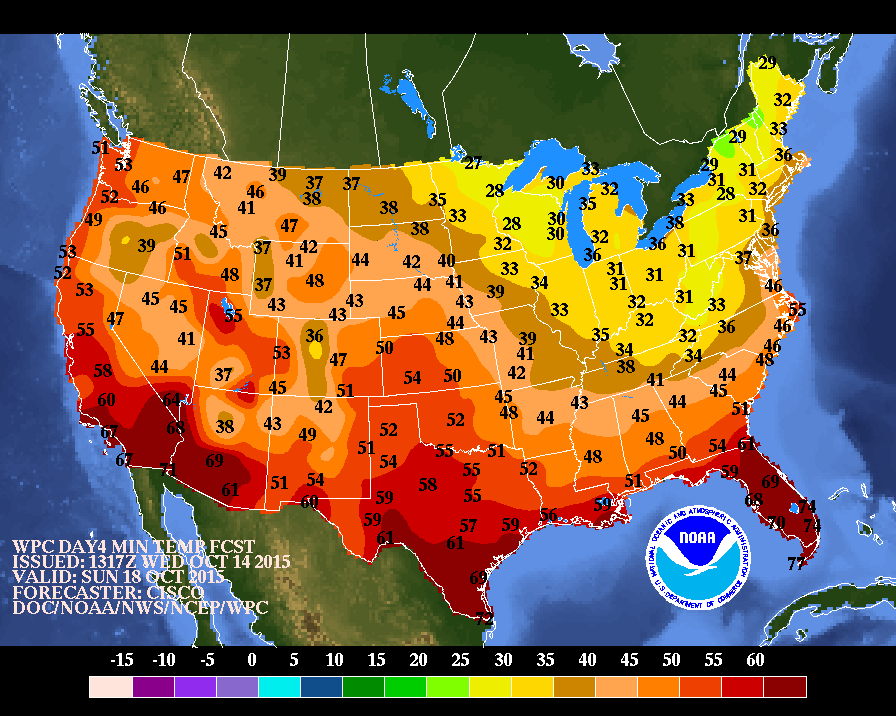
By Friday night the front will push offshore, but an upper-level low pressure area will settle into the region. This will likely trigger additional showers across parts of the Eastern Great Lakes and northern New England. Most of these will be light once again, but with colder air settling in, some wet snow could mix in, especially in the higher elevations of northern New England. Little, if any, accumulation is expected, except at the higher peaks. With the upper-level system nearby, Saturday will be a breezy and cool day across much of the region under partly sunny skies. As this system moves into southeastern Canada, high pressure will build into the Great Lakes, allowing skies to clear out. This may result in frost and/or freezing conditions across most of the Ohio Valley, the Appalachians, and interior Northeast, ending the growing season across much of the region.
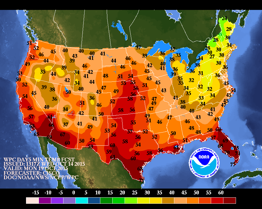
By Sunday, high pressure slides eastward, allowing for a sunny but cool day across most of the Northeast. The exception will be across northern New England. With the upper-level low still nearby, rain and snow showers will continue across the higher elevations of Vermont and New Hampshire, as well as much of northern and western Maine. Accumulation of 1 to 3 inches are expected, with some heavier amounts possible in extreme northern Maine. Skies should become clear across most of the region Sunday night, and with diminishing winds, temperatures will drop quickly at night. A widespread frost and/or freeze is expected across much of New England, mainly away from the coastal plain. Temperatures may only drop into the middle 30s in the urban areas, but most of the suburbs will likely drop into the 20s to lower 30s by Monday morning.
As the high slides offshore, southwest to west winds will allow warmer air to move back in, with high temperatures bouncing back into the 60s and lower 70s by the middle of next week.