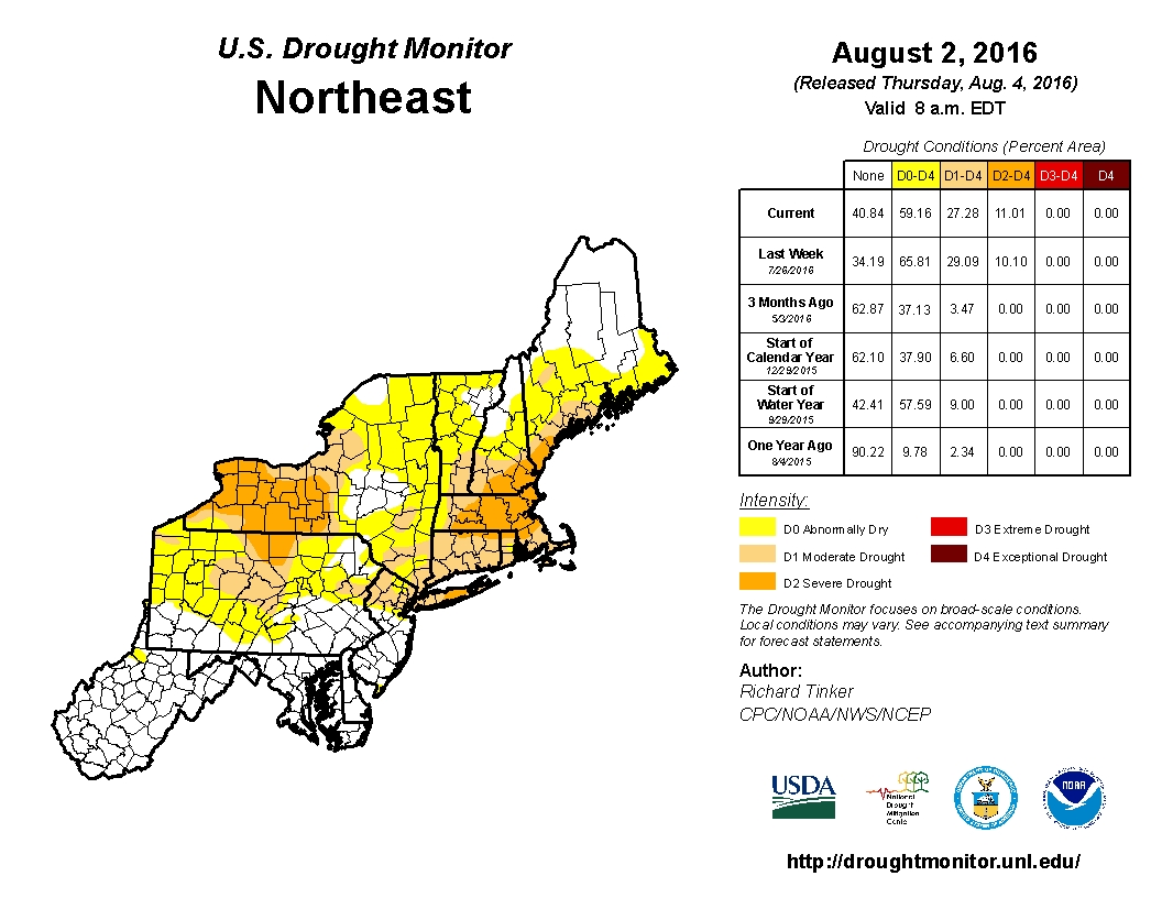
A persistent pattern over the last several months has left much of Northeast in a drought. According to the most recent update from the National Drought Monitor, portions of Western New York and also Central New England are experiencing severe drought.
Heavy showers and thunderstorms have been common across the Mid-Atlantic states recently, eliminating any drought concerns, but the bulk of the rainfall has remained well south or well north of areas that need it the most.
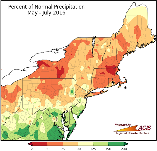
According to data from the Northeast Regional Climate Center, the period between Marc 1 and August 2 is the driest on record for several locations across New York and New England, including cities such as Lawrence, MA, and Elmira and Batavia, NY. Other locations, such as Hartford, CT and Hingham, MA, are in the Top 5 driest March 1-August 2 on record. Many rivers and streams across the region are at near record low levels. Water restrictions and/or bans are in effect for hundreds of cities and towns across the region.
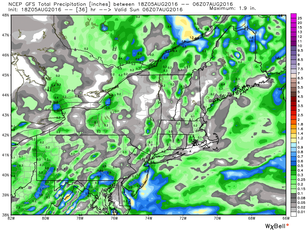
A cold front will cross the region on Saturday, producing scattered showers and thunderstorms. While some of these storms could be locally heavy, most places will receive just light rainfall, which will barely put a dent in the drought. The bigger concern on Saturday is for severe weather across the Northeast. While the timing of the front won’t be optimal for a severe weather outbreak, conditions will be favorable for some strong to severe thunderstorms, especially across Southern New England and southeastern New York during the afternoon hours. Some storms may produce strong winds along with hail and brief downpours.
Once the front moves through, high pressure builds back in with sunshine and dry conditions for the first half of the upcoming week. Another front will move through on Wednesday with a chance for some additional showers and thunderstorms before stalling out across the region. Exactly where that front stalls out will be critical, as waves of low pressure are expected to ride along it, bringing chances for some much-needed rainfall. If the front stalls along the southern New England coast, then some significant rainfall could fall across much of New York and Southern New England. If the front stalls out across the Mid-Atlantic states, then the heaviest rain would be focused there, and not where it is needed most. The forecast models are split on where the front will stall out, so it’s too early to get a good idea of which idea might be correct. However, if history is any indication, then expect the front to stall out to the south. Droughts feed on themselves, which leads to an old forecasting rule of thumb – “When in drought, leave it out”.
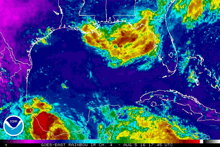
Normally, when the Northeast experiences a drought in the summer, it ends with heavy rainfall from a tropical system, or the remains of a tropical system that made landfall elsewhere. Tropical Storm Earl is moving into eastern Mexico this evening, but it is not expected to have any impacts on the US. However, there is a cluster of thunderstorms in the northeastern Gulf of Mexico that needs to be watched. While development of a tropical cyclone is not expected over the next few days, the system could slowly organize. The main impact from this system will be heavy rainfall across the Gulf Coast, especially in portions of Florida and southern Georgia. Some models are showing the potential for 5-10 inches of rain over the next few days. This will almost certainly lead to flooding in parts of the region.
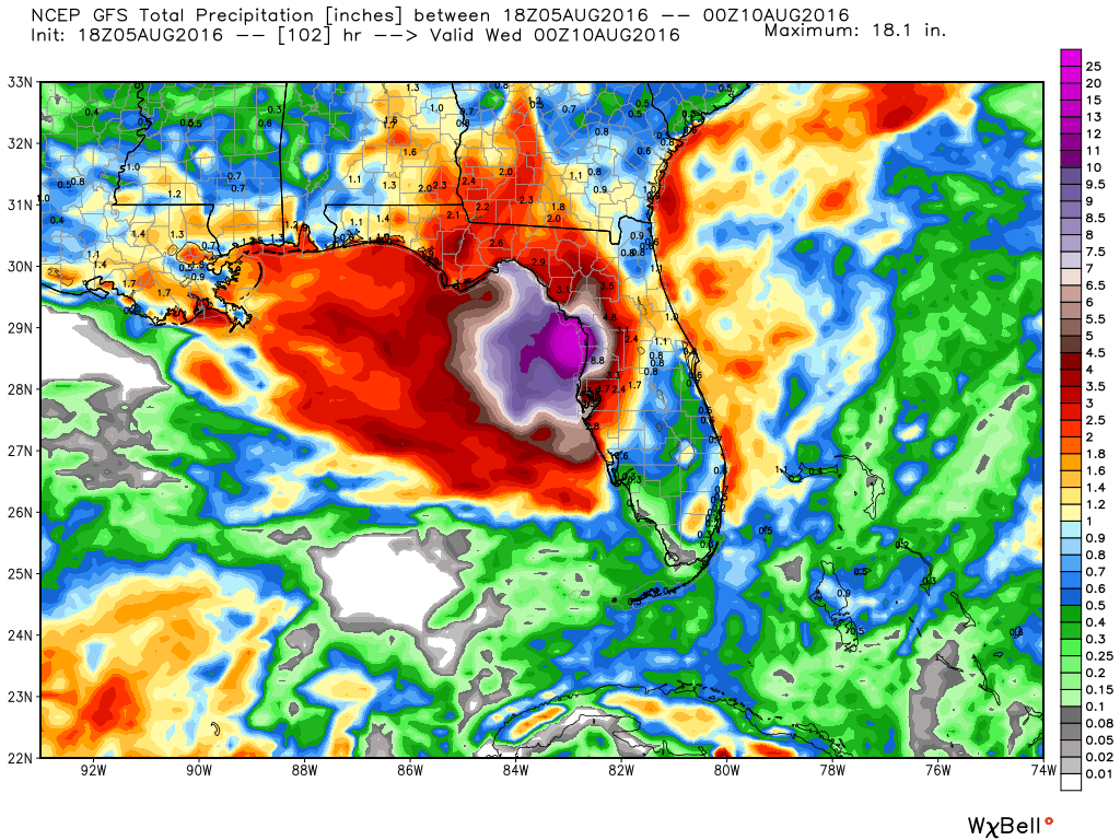
The ideal situation would be for some of this moisture to be drawn northward and ride along the front into the Northeast, finally bringing significant rainfall to the area. While this is a possibility, it does not seem like a likely scenario at this point. In fact, some of the models show the moisture remaining in place across the Northern Gulf of Mexico right through the week, with heavy rain and thunderstorms continuing across the region.