Astronomical fall begins on September 22 at 10:21am EDT, but meteorological fall is defined as the period between September 1 through November 30. While it can and does still feel like summer across parts of the nation, there are more and more signs that summer is winding down.
As the nights start to grow a little longer the farther north you go, the cooler air starts to build up a little more, especially as you head into Canada and Alaska. The cold fronts that drop down from Canada and into the Northern US start to pack a little more punch. One of those fronts is moving across portions of the Upper Midwest and the Great Plains today. The airmass moving into the Rockies and Northern Plains behind the front is sending temperatures as much as 15 to 25 degrees below normal this afternoon.
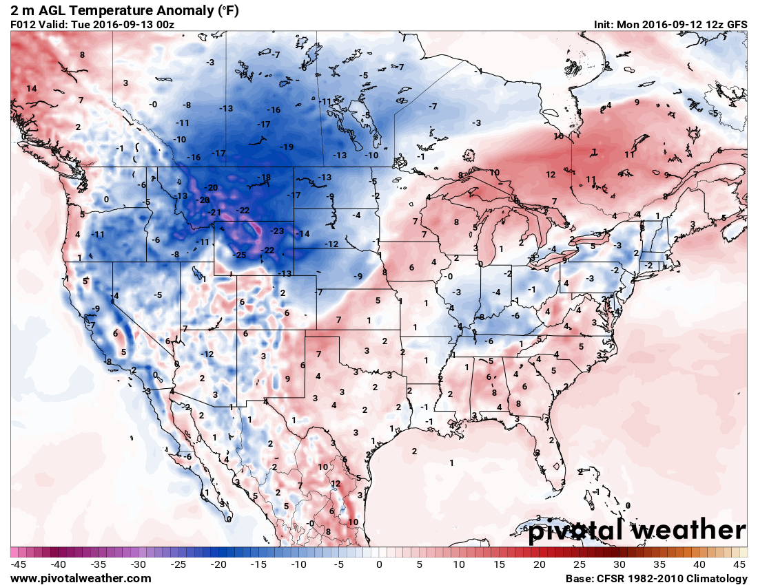
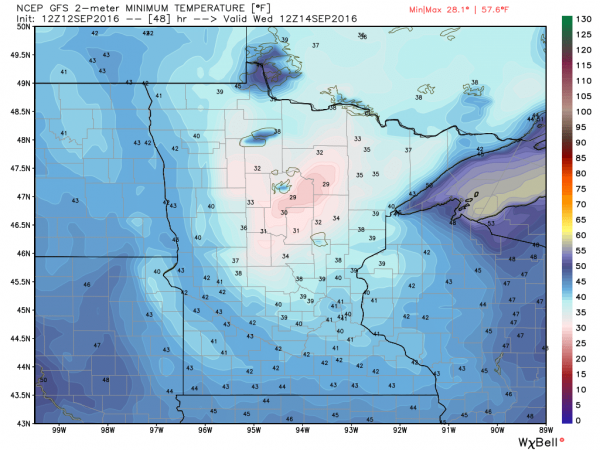
As that airmass settles in, low temperatures will drop into the 30s and 40s across the Northern Plains and Rockies tonight. Frost advisories and freeze warnings have been posted for western portions of North Dakota for Tuesday morning. By Wednesday morning, the coldest air will move over Minnesota, where low temperatures could drop into the upper 20s and 30s. Additional frost and freeze advisories will likely be issued for this region.
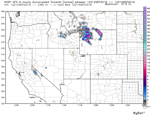
Cold temperatures aren’t the only noteworthy item with this cold front. As the cold air surges into the Rockies, precipitation will accompany it. That precipitation will likely fall as snow in many areas, mainly at elevations above 5000 feet. Across some of the higher peaks, more than a foot of snow could accumulate over the next day or two. Winter Weather Advisories have been issued for portions of northern Wyoming as a result.
Some snow is also possible across the higher elevations of the Sierra Nevada as the cooler air spreads into the West. While accumulations will be minor, this will likely be the first snowfall of the year for this region. Across the rest of the Golden State, temperatures will likely be 6 to 12 degrees below normal on Tuesday, with highs only in the 70s to lower 80s, a welcome change from the 90s and 100s they’ve had for most of the summer.
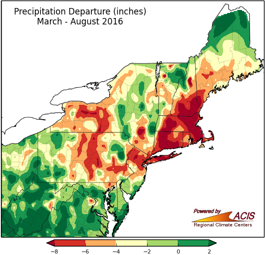
While this front will bring cooler air into the Northeast later this week, one thing it won’t do unfortunately, is bring beneficial rainfall to the region. It will produce showers and some thunderstorms, and while a few of the storms may contain heavy downpours, they’ll be very localized. Across much of the region, rainfall totals will be generally under half an inch. This will do little to put a dent in the severe drought that much of the region is currently experiencing. Rainfall deficits of 5 to 10 inches below normal since the beginning of March are common across the region.
While this early taste of fall moving into much of the Northern US this week is not uncommon for mid-September, it might not be repeated much this fall. Long-range forecasts are showing the likelihood of a warmer than normal fall across much of the United States.